Approximate Location Map
Large Map »
Latitude: 53.2312 / 53°13'52"N
Longitude: -0.8992 / 0°53'57"W
OS Eastings: 473575
OS Northings: 371029
OS Grid: SK735710
Mapcode National: GBR BH8.FGH
Mapcode Global: WHFGW.511Q
Plus Code: 9C5X64J2+F8
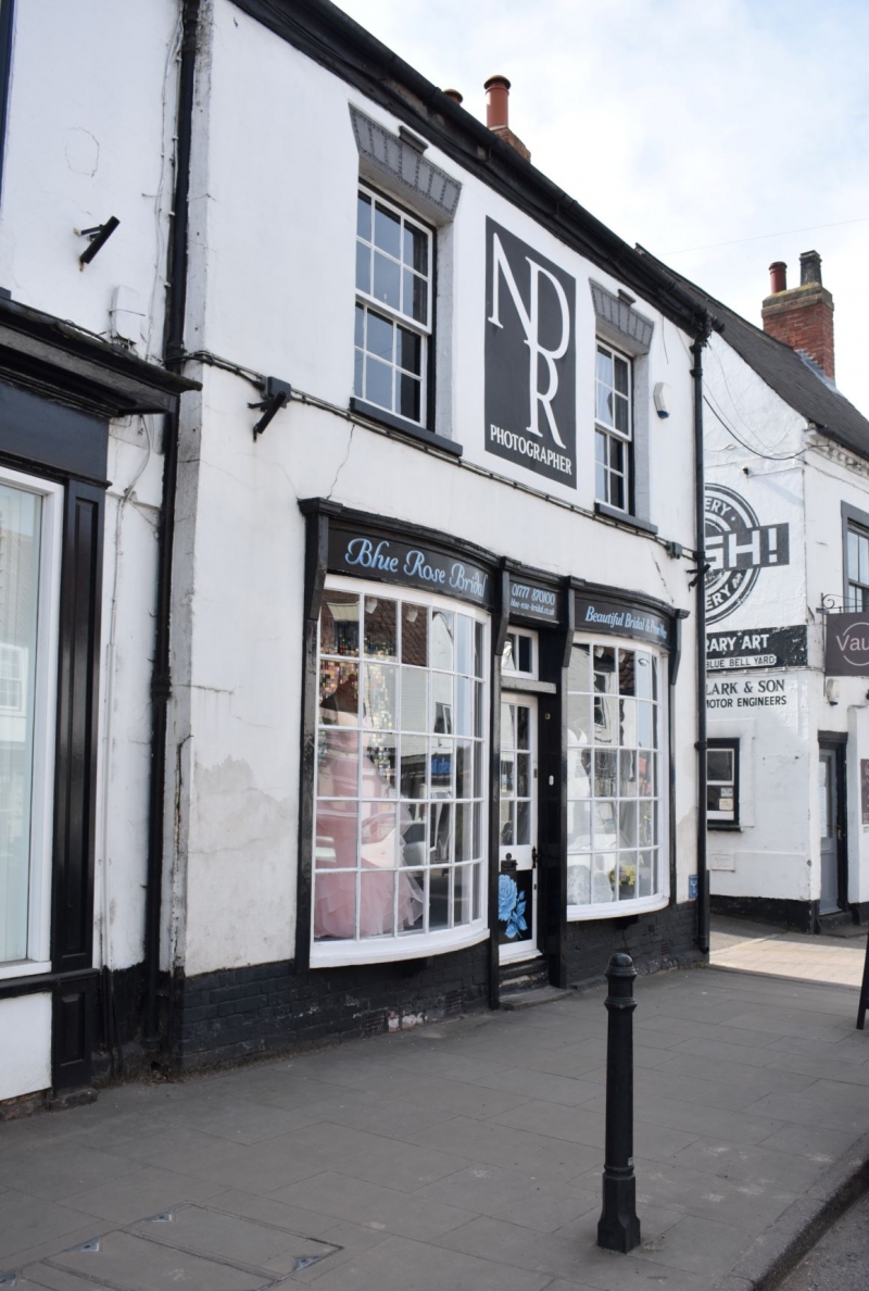
Entry Name: 5, Eldon Street, Tuxford
Listing Date: 1 February 1967
Last Amended: 14 November 1985
Grade: II
Source: Historic England
Source ID: 1224218
English Heritage Legacy ID: 420200
ID on this website: 101224218
Location: Tuxford, Bassetlaw, Nottinghamshire, NG22
County: Nottinghamshire
District: Bassetlaw
Civil Parish: Tuxford
Built-Up Area: Tuxford
Traditional County: Nottinghamshire
Lieutenancy Area (Ceremonial County): Nottinghamshire
Church of England Parish: Tuxford
Church of England Diocese: Southwell and Nottingham
Tagged with: Building
This list entry was subject to a Minor Amendment on 09/04/2015
SK 77 SW
5/63
TUXFORD,
ELDON STREET (west side),
No. 5
(Formerly listed as Shop occupied by C.M.Spencer, No.5.
Previously listed as Bland's newsagent and tobacconists' shop, Chantry Lane)
1.2.67
G.V. II
Shop with domestic accommodation. Mid C18 with C19 windows and late C19 shop front. Stucco, probably over brick. Pantile roof. External right gable stack and remnants of left gable stack. Two and a half storeys, 3 bays. Remains of first floor band, obscured by the shop front. Central doorway with recessed part glazed door and overlight. Either side are single large shop windows each with 6 panes. Above extends an entablature. On the first floor are 3 sashes with painted keystones and above are 3 C20 casements in original openings with painted keystones. To the rear is an outshot under catslide roof and a later extension. Interior has many beams.
Listing NGR: SK7357571029
External links are from the relevant listing authority and, where applicable, Wikidata. Wikidata IDs may be related buildings as well as this specific building. If you want to add or update a link, you will need to do so by editing the Wikidata entry.


Other nearby listed buildings
