Latitude: 51.5013 / 51°30'4"N
Longitude: -0.1803 / 0°10'49"W
OS Eastings: 526402
OS Northings: 179610
OS Grid: TQ264796
Mapcode National: GBR 3J.Q0
Mapcode Global: VHGQY.TJKG
Plus Code: 9C3XGR29+GV
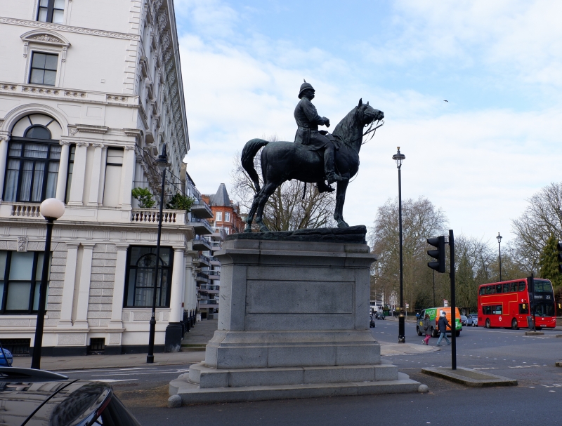
Entry Name: Statue of Field Marshal Lord Napier
Listing Date: 15 April 1969
Grade: II
Source: Historic England
Source ID: 1224311
English Heritage Legacy ID: 420342
ID on this website: 101224311
Location: Knightsbridge, Kensington and Chelsea, London, SW7
County: London
District: City of Westminster
Electoral Ward/Division: Queen's Gate
Parish: Non Civil Parish
Built-Up Area: Kensington and Chelsea
Traditional County: Middlesex
Lieutenancy Area (Ceremonial County): Greater London
Church of England Parish: Holy Trinity South Kensington
Church of England Diocese: London
TQ 2679 NW
32/9
KENSINGTON ROAD W8
Statue of Field Marshal Lord Napier
15.4.69
II
Bronze equestrian statue to Field Marshal Lord Napier (1810-1890) on base of grey
granite. Half in City of Westminster.
Listing NGR: TQ2640379610


Other nearby listed buildings