Approximate Location Map
Large Map »
Latitude: 51.5004 / 51°30'1"N
Longitude: -0.1909 / 0°11'27"W
OS Eastings: 525671
OS Northings: 179487
OS Grid: TQ256794
Mapcode National: GBR 1J.BB
Mapcode Global: VHGQY.MKY5
Plus Code: 9C3XGR25+4M
Entry Name: 29, Kensington Square W8
Listing Date: 15 April 1969
Grade: II
Source: Historic England
Source ID: 1224525
English Heritage Legacy ID: 420609
ID on this website: 101224525
Location: Kensington, Kensington and Chelsea, London, W8
County: London
District: Kensington and Chelsea
Electoral Ward/Division: Queen's Gate
Parish: Non Civil Parish
Built-Up Area: Kensington and Chelsea
Traditional County: Middlesex
Lieutenancy Area (Ceremonial County): Greater London
Church of England Parish: St Mary Abbots with Christ Church and St Philip Kensington
Church of England Diocese: London
Tagged with: Building
TQ 2579 SE KENSINGTON SQUARE W8
37/16 (west side)
15.4.69 No 29
GV
II
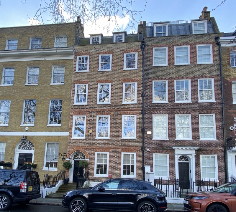
House. Late C17 or early C18. Four storey + attic, 3 window, brown brick red dressings.
Doorcase about 1790 with columns with feathers capitals under carved frieze and
cornice. Interior, panelling, and fine stair.
Listing NGR: TQ2567179487
External links are from the relevant listing authority and, where applicable, Wikidata. Wikidata IDs may be related buildings as well as this specific building. If you want to add or update a link, you will need to do so by editing the Wikidata entry.


Other nearby listed buildings
