Approximate Location Map
Large Map »
Latitude: 51.2709 / 51°16'15"N
Longitude: 0.525 / 0°31'29"E
OS Eastings: 576230
OS Northings: 155449
OS Grid: TQ762554
Mapcode National: GBR PR7.7JS
Mapcode Global: VHJMF.1BW1
Plus Code: 9F327GCF+9X
Entry Name: 44, Lower Stone Street
Listing Date: 2 August 1974
Grade: II
Source: Historic England
Source ID: 1224693
English Heritage Legacy ID: 173404
ID on this website: 101224693
Location: Maidstone, Kent, ME15
County: Kent
District: Maidstone
Electoral Ward/Division: High Street
Parish: Non Civil Parish
Built-Up Area: Maidstone
Traditional County: Kent
Lieutenancy Area (Ceremonial County): Kent
Tagged with: Building
LOWER STONE STREET
1.
5278
(West Side)
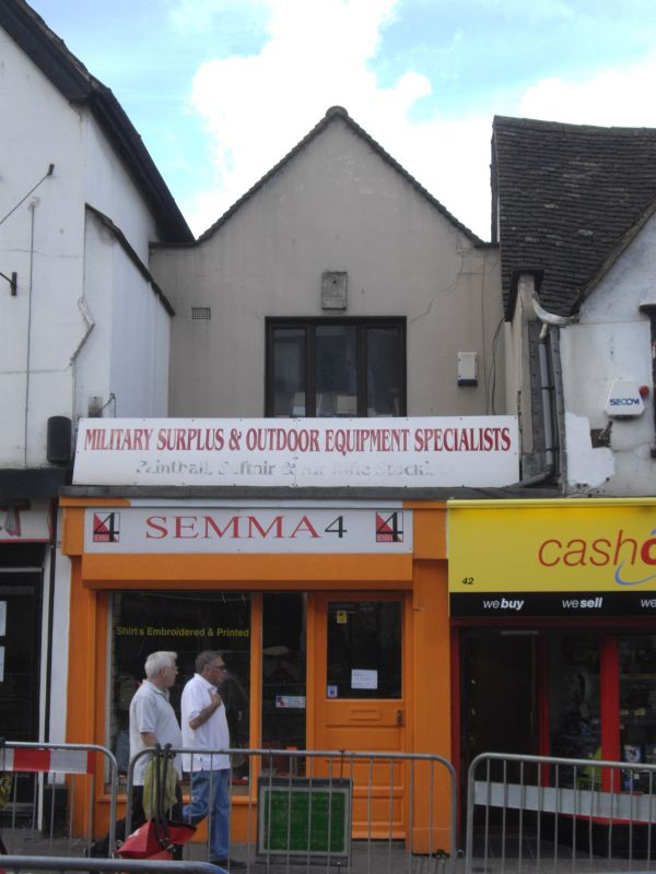
No 44
TQ 7655 SW 7/308
II GV
2.
A C17 timber-framed building of 2 storeys rendered. Gable front. Tiled roof.
1 altered 3-light casement. Later shopfront projects forward. Grade II for
group value.
Nos 26 to 36 (even), 40 to 46 (even) and 50 to 70 (even) form a group,
Listing NGR: TQ7622555447
External links are from the relevant listing authority and, where applicable, Wikidata. Wikidata IDs may be related buildings as well as this specific building. If you want to add or update a link, you will need to do so by editing the Wikidata entry.


Other nearby listed buildings
