Latitude: 51.3546 / 51°21'16"N
Longitude: 1.2504 / 1°15'1"E
OS Eastings: 626411
OS Northings: 166738
OS Grid: TR264667
Mapcode National: GBR VYV.4XL
Mapcode Global: VHLGB.M6DX
Plus Code: 9F339732+R5
Entry Name: Streete House
Listing Date: 13 October 1952
Grade: II
Source: Historic England
Source ID: 1224797
English Heritage Legacy ID: 420944
ID on this website: 101224797
Location: St Nicholas at Wade, Thanet, Kent, CT7
County: Kent
District: Thanet
Civil Parish: St. Nicholas at Wade
Built-Up Area: St Nicholas at Wade
Traditional County: Kent
Lieutenancy Area (Ceremonial County): Kent
Tagged with: House
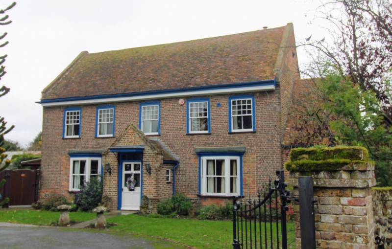
ST NICHOLAS AT WADE COURT ROAD TR 26 NE (north side) 1/78 Streete House 13-10-52 GV II House. Early C17. Red brick and plain tiled roof. Two storeys on plinth with moulded and boxed eaves cornice to roof with kneelered gables and stack to rear right. Five segmental headed glazing bar sashes on first floor, and 2 canted bay windows on ground floor each blocking 2 segmental headed window openings. Central door of 6 panels, the top 4 glazed, with rectangular fan- light and flat hood on metal brackets. Single storey extension to right with 1 sash, and C19 wings to rear. Interior: moulded ceiling joists. Panelled room with filleted frieze on fluted pilasters around door, with moulded muntins. Panelled overmantel with 2 enriched semi-circular arches on fluted pilasters with modillion cornice and fluted frieze and lozenges in panels contemporary fireback (dated 1635).
Listing NGR: TR2640966739
External links are from the relevant listing authority and, where applicable, Wikidata. Wikidata IDs may be related buildings as well as this specific building. If you want to add or update a link, you will need to do so by editing the Wikidata entry.


Other nearby listed buildings