Approximate Location Map
Large Map »
Latitude: 51.2716 / 51°16'17"N
Longitude: 0.52 / 0°31'12"E
OS Eastings: 575884
OS Northings: 155509
OS Grid: TQ758555
Mapcode National: GBR PR7.68W
Mapcode Global: VHJMD.Y9SK
Plus Code: 9F327GCC+J2
Entry Name: Gateway and Wall to Palace Gardens
Listing Date: 2 August 1974
Grade: II
Source: Historic England
Source ID: 1224844
English Heritage Legacy ID: 173431
ID on this website: 101224844
THis list entry was subject to a Minor Amendment on 28/02/2107
TQ 7555 SE
6/323
MILL STREET (West Side)
Gateway and Wall to Palace Gardens
GV
II
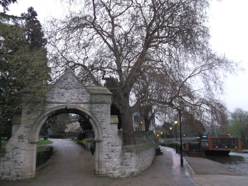
The gateway is dated 1888 and is built of Kentish ragstone. Semi-circular arch with a keystone in the shape of a shell above. The date stone is above the arch end is flanked by swags. On the left hand side there is a wall of ragstone about 7 ft high.
Gateway and Wall to Palace Gardens, Wall to north west of Archbishop's Palace, The Archbishop's Palace, Wall to east of Archbishop's Palace, The Dungeons at the Archbishop's Palace, The Gate House at the Archbishop's Palace, The Len Bridge, The Tithe Barn, Parish Church of All Saints, Wall to north and west of All Saints Church, The College Gateway, The College Tower, The Master's House, The Master's Tower, Cutbush Almshouses and the Ruined Gateway form a group.
Listing NGR: TQ7585755504
External links are from the relevant listing authority and, where applicable, Wikidata. Wikidata IDs may be related buildings as well as this specific building. If you want to add or update a link, you will need to do so by editing the Wikidata entry.


Other nearby listed buildings
