Latitude: 51.4817 / 51°28'54"N
Longitude: -0.187 / 0°11'13"W
OS Eastings: 525988
OS Northings: 177417
OS Grid: TQ259774
Mapcode National: GBR 2R.61
Mapcode Global: VHGR4.P0ZZ
Plus Code: 9C3XFRJ7+M5
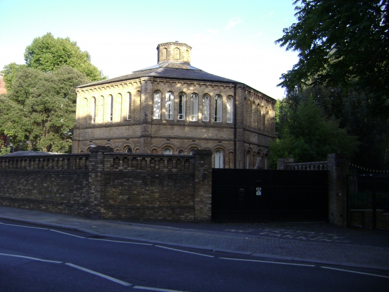
Entry Name: Octagon at College of St Mark and St John
Listing Date: 15 April 1969
Grade: II
Source: Historic England
Source ID: 1225047
English Heritage Legacy ID: 421290
ID on this website: 101225047
Location: Walham Green, Kensington and Chelsea, London, SW10
County: London
District: Kensington and Chelsea
Electoral Ward/Division: Stanley
Parish: Non Civil Parish
Built-Up Area: Kensington and Chelsea
Traditional County: Middlesex
Lieutenancy Area (Ceremonial County): Greater London
Church of England Parish: Chelsea St John with St Andrew
Church of England Diocese: London
Tagged with: Architectural structure
TQ 2577 SE KING'S ROAD SW3
66/1 (north side)
15.4.69
Octagon at College of
St Mark and St John
GV
II
Octagon probably the work of Edward Blore and Derwent Coleridge. Buff brick.
Listing NGR: TQ2598877417
External links are from the relevant listing authority and, where applicable, Wikidata. Wikidata IDs may be related buildings as well as this specific building. If you want to add or update a link, you will need to do so by editing the Wikidata entry.


Other nearby listed buildings