Approximate Location Map
Large Map »
Latitude: 51.519 / 51°31'8"N
Longitude: -0.2108 / 0°12'38"W
OS Eastings: 524236
OS Northings: 181522
OS Grid: TQ242815
Mapcode National: GBR BD.ZG5
Mapcode Global: VHGQY.92DW
Plus Code: 9C3XGQ9Q+HM
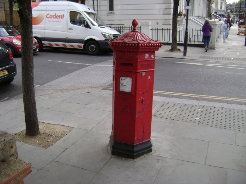
Entry Name: Pillar Box on North East Corner with Oxford Gardens
Listing Date: 7 November 1984
Grade: II
Source: Historic England
Source ID: 1225243
English Heritage Legacy ID: 421390
ID on this website: 101225243
Location: North Kensington, Kensington and Chelsea, London, W10
County: London
District: Kensington and Chelsea
Electoral Ward/Division: Golborne
Parish: Non Civil Parish
Built-Up Area: Kensington and Chelsea
Traditional County: Middlesex
Lieutenancy Area (Ceremonial County): Greater London
Church of England Parish: St Michaell and All Angels Ladbroke Grove
Church of England Diocese: London
Tagged with: Pillar box
TQ 2481 NW LADBROKE GROVE W10
10/3
Pillar Box on north-east
corner with Oxford Gardens
II
Mid C19. Hexagonal. Pillar box. Penfold pattern.
Listing NGR: TQ2423681522
External links are from the relevant listing authority and, where applicable, Wikidata. Wikidata IDs may be related buildings as well as this specific building. If you want to add or update a link, you will need to do so by editing the Wikidata entry.


Other nearby listed buildings
