Approximate Location Map
Large Map »
Latitude: 50.9855 / 50°59'7"N
Longitude: -0.6081 / 0°36'29"W
OS Eastings: 497796
OS Northings: 121594
OS Grid: SU977215
Mapcode National: GBR FGL.330
Mapcode Global: FRA 96MH.T2Z
Plus Code: 9C2XX9PR+5Q
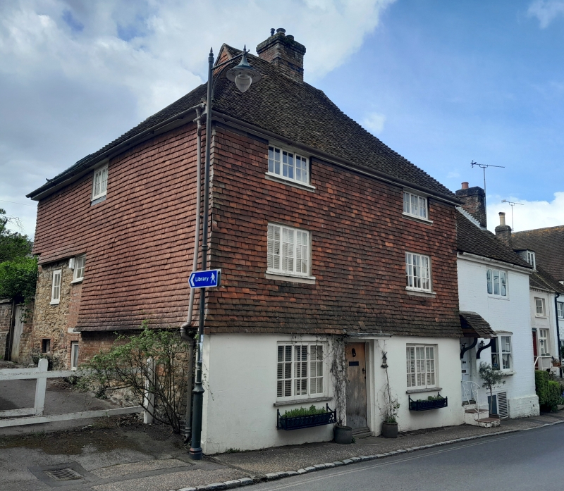
Entry Name: Windmill House
Listing Date: 5 November 1973
Grade: II
Source: Historic England
Source ID: 1225285
English Heritage Legacy ID: 421590
ID on this website: 101225285
Location: Petworth, Chichester, West Sussex, GU28
County: West Sussex
District: Chichester
Civil Parish: Petworth
Built-Up Area: Petworth
Traditional County: Sussex
Lieutenancy Area (Ceremonial County): West Sussex
Church of England Parish: Petworth St Mary
Church of England Diocese: Chichester
Tagged with: House
SU 9721 PETWORTH HIGH STREET
(south side)
29/289
Windmill House
5.11.73
GV II
Formerly two cottages now house. C17 or earlier timber-framed building refaced with
stucco on the ground floor and tile-hung above. Steeply-.pitched hipped tiled roof
with pentice behind. Casement windows. Three storeys. Two windows.
Listing NGR: SU9779621594
External links are from the relevant listing authority and, where applicable, Wikidata. Wikidata IDs may be related buildings as well as this specific building. If you want to add or update a link, you will need to do so by editing the Wikidata entry.


Other nearby listed buildings
