Latitude: 51.2818 / 51°16'54"N
Longitude: 0.519 / 0°31'8"E
OS Eastings: 575773
OS Northings: 156643
OS Grid: TQ757566
Mapcode National: GBR PR1.D24
Mapcode Global: VHJMD.Y17P
Plus Code: 9F327GJ9+PJ
Entry Name: 75 and 76, Sandling Road
Listing Date: 2 August 1974
Grade: II
Source: Historic England
Source ID: 1225390
English Heritage Legacy ID: 173478
ID on this website: 101225390
Location: Ringlestone, Maidstone, Kent, ME14
County: Kent
District: Maidstone
Electoral Ward/Division: North
Parish: Non Civil Parish
Built-Up Area: Maidstone
Traditional County: Kent
Lieutenancy Area (Ceremonial County): Kent
Tagged with: Building
SANDLING ROAD 1. 5278 (East Side) Nos 75 & 76 TQ 75 NE 9/123 II GV
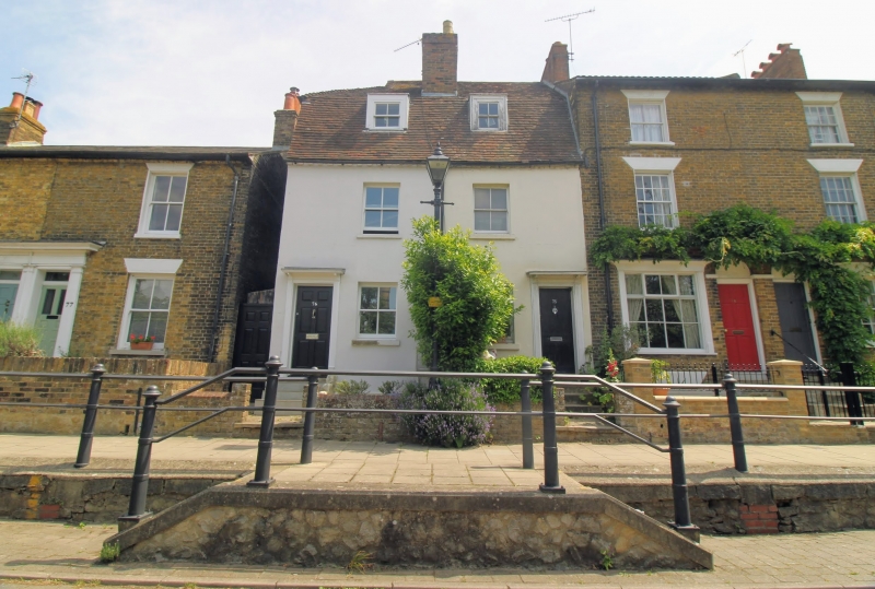
2. C18. 2 storeys and basement stuccoed. Mansard tiled roof with 2 dormers. 1 sash each with verticals only. Doorcases with moulded architraves and flat hoods over. Plinth.
Nos 63 to 90 (consec), The Flowerpot Public House and the Embankment and Railings opposite Nos 63 to 90 (consec) and The Flowerpot Public House form a group.
Listing NGR: TQ7577556642
External links are from the relevant listing authority and, where applicable, Wikidata. Wikidata IDs may be related buildings as well as this specific building. If you want to add or update a link, you will need to do so by editing the Wikidata entry.


Other nearby listed buildings