Latitude: 51.1275 / 51°7'38"N
Longitude: 0.2614 / 0°15'41"E
OS Eastings: 558341
OS Northings: 138899
OS Grid: TQ583388
Mapcode National: GBR MPZ.6XS
Mapcode Global: VHHQD.HX2K
Plus Code: 9F3247G6+XH
Entry Name: 5 and 7, Little Mount Sion
Listing Date: 29 June 1987
Grade: II
Source: Historic England
Source ID: 1225885
English Heritage Legacy ID: 168180
ID on this website: 101225885
Location: Royal Tunbridge Wells, Tunbridge Wells, Kent, TN1
County: Kent
District: Tunbridge Wells
Electoral Ward/Division: Pantiles and St Mark's
Parish: Non Civil Parish
Built-Up Area: Royal Tunbridge Wells
Traditional County: Kent
Lieutenancy Area (Ceremonial County): Kent
Church of England Parish: Tunbridge Wells Holy Trinity with Christ Church
Church of England Diocese: Rochester
Tagged with: Building
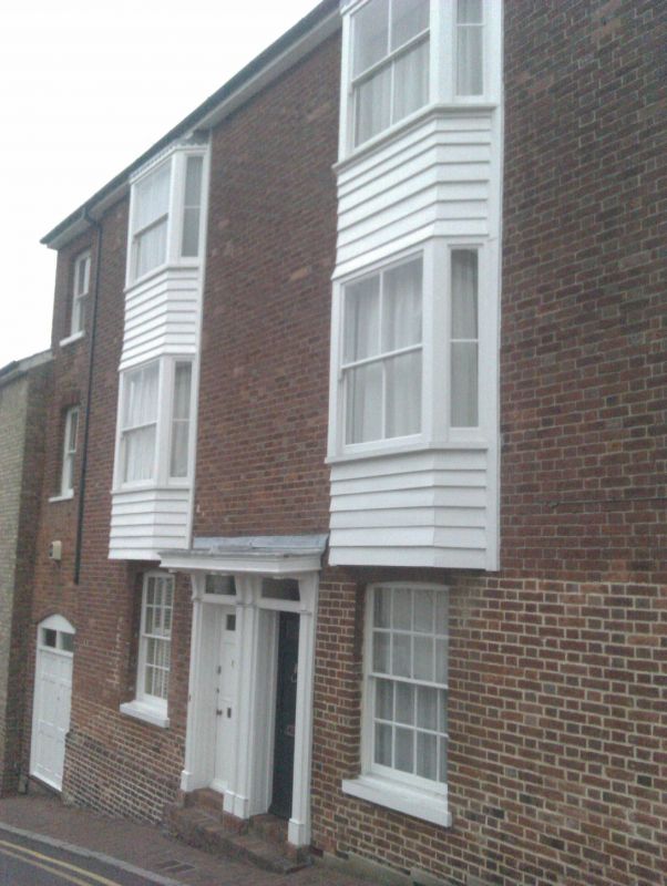
Little Mount Sion TQ 5838 NW 1/234 Nos 5 and 7 II House pair. Built between 1780 and 1815 with same alterations after the middle of the C19. Red brick in Flemish bond. Slate roof. Rear elevation and right side elevation partially tile hung. 3 storeys, 3 windows. Front elevation has 2 3-light canted bays through the 2 upper floors boarded over at time of survey but probably having later C19 mullioned and transomed windows. Left side cambered sash with verticals only and horns with flower guard to 1st floor window. Ground floor has 2 cambered 16 pane sashes and cambered entrance to rear passage to left. Paired wooden doorcase with incised pilasters, flat hoods on brackets and rectangular fanlights. Plinth. Rear elevation is tile hung on the 2 upper floors which projects over stock brick ground floor. 2 16-pane sashes. Later weather- boarded projection obscuring 2 windows.
Listing NGR: TQ5834138899
External links are from the relevant listing authority and, where applicable, Wikidata. Wikidata IDs may be related buildings as well as this specific building. If you want to add or update a link, you will need to do so by editing the Wikidata entry.


Other nearby listed buildings