Latitude: 50.969 / 50°58'8"N
Longitude: -2.7686 / 2°46'7"W
OS Eastings: 346123
OS Northings: 119123
OS Grid: ST461191
Mapcode National: GBR MH.M8DD
Mapcode Global: FRA 562K.568
Plus Code: 9C2VX69J+HG
Entry Name: South Gateway and Stocks Immediately South East with Steps and Railings, Church of All Saints
Listing Date: 28 April 1987
Grade: II
Source: Historic England
Source ID: 1225950
English Heritage Legacy ID: 422984
ID on this website: 101225950
Location: All Saints' Church, Martock, Somerset, TA12
County: Somerset
District: South Somerset
Civil Parish: Martock
Built-Up Area: Martock
Traditional County: Somerset
Lieutenancy Area (Ceremonial County): Somerset
Tagged with: Architectural structure
South Gateway & Stocks etc, Church Street 12/240 9/240
------------------------------------
South Gateway & Stocks etc, Church Street 12/240 9/240
------------------------------------ ST4619 MARTOCK CP CHURCH STREET (West side)
12/240 South gateway and stocks immediately south-east, with steps and railings, Church of All Saints 19.4.61
GV II
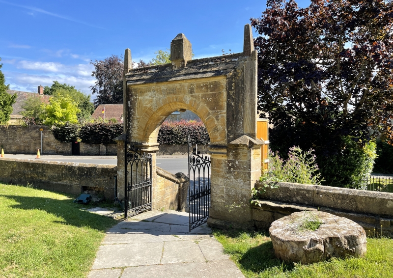
Gateway, steps and stocks. Gateway dated 1627. Ham stone, with wrot iron work. In form of short, tall ashlar wall with stepped angled coping, returned down the sides, with 3 pinnacles on top, framing a moulded semi-circular archway with false keystone and impost blocks; with an approach of 4 steps with matching baluster walls ending in square piers with bell-hip caps. The gates early C19, featuring Gothic arches, scrolls, barbed arrowpoints and other Regency style decoration; railings to corners formed by projecting stairs set on low stone base now almost sunken, having plain arrowhead tops; on south-west side railings enclose a notice board, and on south-east the stocks, 4 leg-holes with iron straps, under wrot iron and oak plank roof. An inscription over the archway reads: Robert Jeane and Thomas Row, Churchwardens, Ano Dni 1627".
Listing NGR: ST4612319122
External links are from the relevant listing authority and, where applicable, Wikidata. Wikidata IDs may be related buildings as well as this specific building. If you want to add or update a link, you will need to do so by editing the Wikidata entry.


Other nearby listed buildings