Approximate Location Map
Large Map »
Latitude: 52.9236 / 52°55'24"N
Longitude: -1.4849 / 1°29'5"W
OS Eastings: 434727
OS Northings: 336367
OS Grid: SK347363
Mapcode National: GBR PHF.LB
Mapcode Global: WHDGT.5S52
Plus Code: 9C4WWGF8+C2
Entry Name: 100, Friar Gate
Listing Date: 20 June 1952
Grade: II
Source: Historic England
Source ID: 1227745
English Heritage Legacy ID: 402030
ID on this website: 101227745
Location: Derby, Derbyshire, DE1
County: City of Derby
Electoral Ward/Division: Arboretum
Parish: Non Civil Parish
Built-Up Area: Derby
Traditional County: Derbyshire
Lieutenancy Area (Ceremonial County): Derbyshire
Church of England Parish: Derby St Alkmund and St Werburgh
Church of England Diocese: Derby
Tagged with: Building
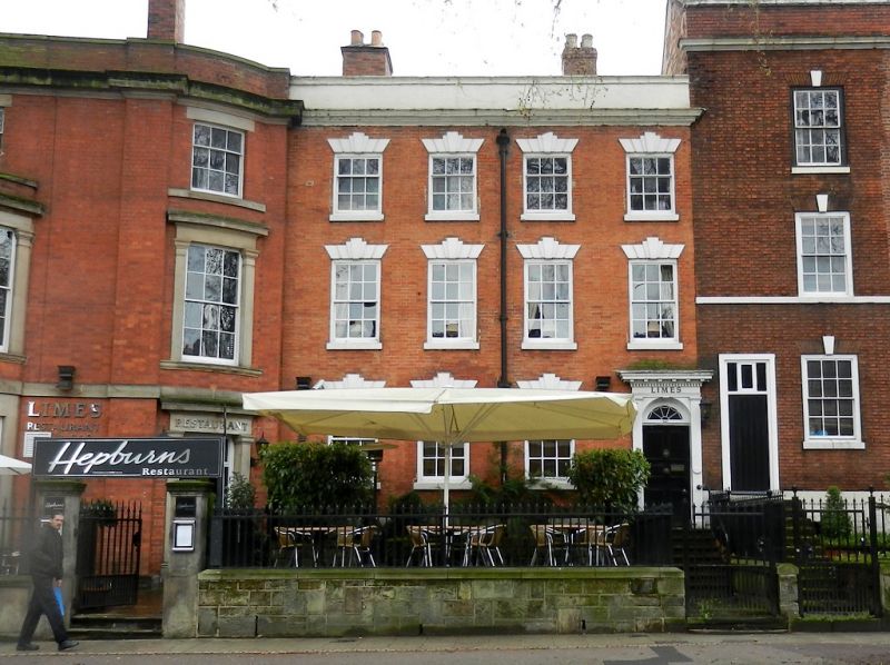
FRIAR GATE
1.
5170
(South Side)
No 100
SK 3436 SE 4/131
20.6.52.
II
2.
Mid C18. 3 storeys; 4 sash windows with stone keyblocks and rusticated lintels;
doorway on right-hand side with wood case, plain pilasters, radial fanlight and
modillion cornice; moulded stone eaves cornice, parapet.
Listing NGR: SK3472736367
External links are from the relevant listing authority and, where applicable, Wikidata. Wikidata IDs may be related buildings as well as this specific building. If you want to add or update a link, you will need to do so by editing the Wikidata entry.


Other nearby listed buildings
