Latitude: 53.6146 / 53°36'52"N
Longitude: -1.8074 / 1°48'26"W
OS Eastings: 412836
OS Northings: 413132
OS Grid: SE128131
Mapcode National: GBR HVTN.H0
Mapcode Global: WHCB7.6DKV
Plus Code: 9C5WJ57V+R2
Entry Name: 110, Moor Lane
Listing Date: 29 September 1978
Grade: II
Source: Historic England
Source ID: 1227783
English Heritage Legacy ID: 401897
ID on this website: 101227783
Location: Netherton, Kirklees, West Yorkshire, HD4
County: Kirklees
Electoral Ward/Division: Crosland Moor and Netherton
Parish: Non Civil Parish
Built-Up Area: Netherton
Traditional County: Yorkshire
Lieutenancy Area (Ceremonial County): West Yorkshire
Church of England Parish: South Crosland Holy Trinity
Church of England Diocese: Leeds
Tagged with: Building
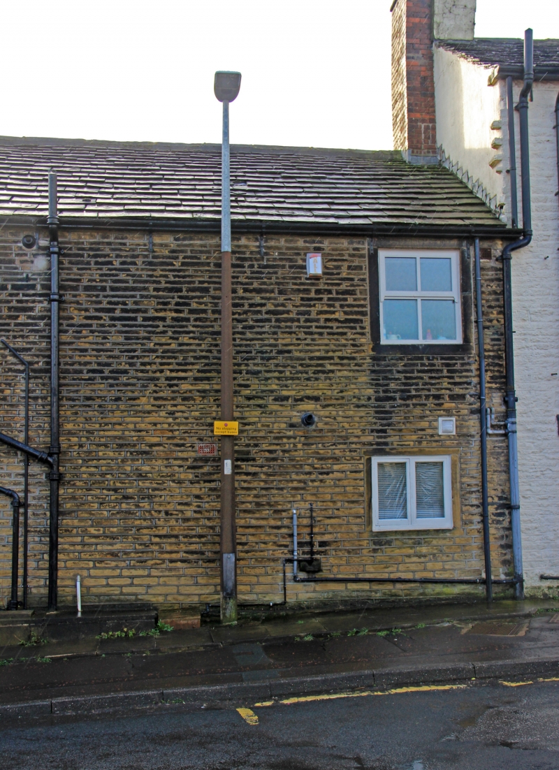
MOOR LANE
1.
5113
(South Side)
Netherton
No 110
SE 1213 47/962
II GV
2.
C18. Hammer-dressed stone. Pitched stone slate roof. 2 storeys. One 2-light
stone mullioned sash on 1st floor. One 3-light stone mullioned window on ground
floor.
Listing NGR: SE1283613132
External links are from the relevant listing authority and, where applicable, Wikidata. Wikidata IDs may be related buildings as well as this specific building. If you want to add or update a link, you will need to do so by editing the Wikidata entry.


Other nearby listed buildings