Approximate Location Map
Large Map »
Latitude: 53.5703 / 53°34'13"N
Longitude: -1.7561 / 1°45'21"W
OS Eastings: 416248
OS Northings: 408216
OS Grid: SE162082
Mapcode National: GBR JW54.LW
Mapcode Global: WHCBG.0J19
Plus Code: 9C5WH6CV+4H
Entry Name: 6.5 Miles Post Opposite No 30
Listing Date: 4 August 1983
Grade: II
Source: Historic England
Source ID: 1228473
English Heritage Legacy ID: 340515
ID on this website: 101228473
SE 10 NE SHEFFIELD ROAD
5/288 (New Mill)
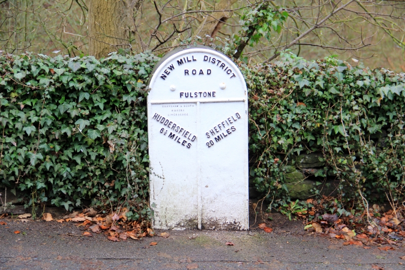
6½ Miles Post
Opposite No 30
II
Mile post. Mid-late C19. Cast iron triangular front with rounded top, on stone
post. Inscribed: NEW MILL DISTRICT
ROAD
FULSTONE
HUDDERSFIELD SHEFFIELD
6½ MILES 20 MILES
Listing NGR: SE1624808216
External links are from the relevant listing authority and, where applicable, Wikidata. Wikidata IDs may be related buildings as well as this specific building. If you want to add or update a link, you will need to do so by editing the Wikidata entry.


Other nearby listed buildings
