Latitude: 50.7352 / 50°44'6"N
Longitude: -2.7595 / 2°45'34"W
OS Eastings: 346494
OS Northings: 93114
OS Grid: SY464931
Mapcode National: GBR PP.04PR
Mapcode Global: FRA 5734.GRL
Plus Code: 9C2VP6PR+35
Entry Name: 21-25, Victoria Grove
Listing Date: 19 September 1975
Grade: II
Source: Historic England
Source ID: 1228524
English Heritage Legacy ID: 402965
ID on this website: 101228524
Location: Bridport, Dorset, DT6
County: Dorset
Civil Parish: Bridport
Built-Up Area: Bridport
Traditional County: Dorset
Lieutenancy Area (Ceremonial County): Dorset
Church of England Parish: Bridport St Mary
Church of England Diocese: Salisbury
Tagged with: Building
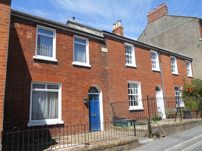
1.
5191 VICTORIA GROVE
(West Side)
Nos 21 to 25 (odd)
SY 4693 2/468
II GV
2.
Late C18. Red brick. Pitched slate roof. Red brick stack. 2 storeys.
2 ranges of sashes with glazing bars (No 21's modern plate glass). 3 doors
with semi-circular fanlights, No 21's modern, others with 4 moulded panels.
Nos 13 to 25 (odd) form a group.
Listing NGR: SY4649193109
External links are from the relevant listing authority and, where applicable, Wikidata. Wikidata IDs may be related buildings as well as this specific building. If you want to add or update a link, you will need to do so by editing the Wikidata entry.


Other nearby listed buildings