Latitude: 53.079 / 53°4'44"N
Longitude: -0.8136 / 0°48'48"W
OS Eastings: 479572
OS Northings: 354186
OS Grid: SK795541
Mapcode National: GBR CLF.YZS
Mapcode Global: WHFHH.GVSY
Plus Code: 9C5X35HP+HH
Entry Name: Causeway Arches and Embankment Walling 50 Metres North West of Trent Bridge
Listing Date: 12 March 1991
Grade: II
Source: Historic England
Source ID: 1228781
English Heritage Legacy ID: 384998
ID on this website: 101228781
Location: Newark-on-Trent, Newark and Sherwood, Nottinghamshire, NG24
County: Nottinghamshire
District: Newark and Sherwood
Civil Parish: Newark
Built-Up Area: Newark-on-Trent
Traditional County: Nottinghamshire
Lieutenancy Area (Ceremonial County): Nottinghamshire
Church of England Parish: Newark-upon-Trent with Coddington
Church of England Diocese: Southwell and Nottingham
Tagged with: Architectural structure Causeway
SK7954SE
619-1/5/380
12/03/91
NEWARK ON TRENT
GREAT NORTH ROAD
(South West side) walling 50m NW of Trent Bridge
GV
II
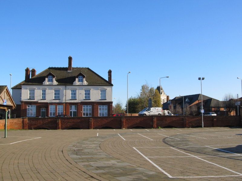
Causeway arches and embankment walling with gates. 1770 with
mid C19 alterations. Designed by John Smeaton. Red brick with
ashlar dressings. Walling runs for 80metres along the
south-west side of the Great North Road, with buttresses at
regular intervals. To the south-east a 30 metre section of
wall slightly curved, with ashlar coping. Then a mid C19
gateway, inserted as an entrance to the cattle market, with
square brick piers with blue brick and ashlar decoration, and
a pair of iron gates. Beyond to the north-west 40 metres of
walling with 9 segmental brick arches (2 not visible), stretching
under the road to the north-east, with buttresses between.
The corresponding north wall of this causeway and embankment
walling was demolished when the road was widened in the C19.
Part of a causeway carrying the Great North Road across the
flood plain of the Trent.
Listing NGR: SK7957254186
External links are from the relevant listing authority and, where applicable, Wikidata. Wikidata IDs may be related buildings as well as this specific building. If you want to add or update a link, you will need to do so by editing the Wikidata entry.


Other nearby listed buildings