Latitude: 50.7339 / 50°44'2"N
Longitude: -2.7608 / 2°45'38"W
OS Eastings: 346402
OS Northings: 92973
OS Grid: SY464929
Mapcode National: GBR PP.0BB5
Mapcode Global: FRA 5734.N7P
Plus Code: 9C2VP6MQ+HM
Entry Name: 52, West Street
Listing Date: 19 September 1975
Grade: II
Source: Historic England
Source ID: 1229070
English Heritage Legacy ID: 403842
ID on this website: 101229070
Location: Bridport, Dorset, DT6
County: Dorset
Civil Parish: Bridport
Built-Up Area: Bridport
Traditional County: Dorset
Lieutenancy Area (Ceremonial County): Dorset
Church of England Parish: Bridport St Mary
Church of England Diocese: Salisbury
Tagged with: Building
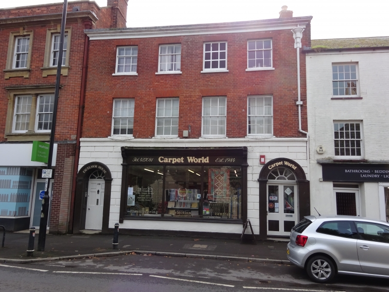
1.
5191 WEST STREET
(South Side)
No 52
SY 4692 3/168
II
2.
Early C19. Red brick. 3 storeys. Eaves cornice. 4 ranges of sashes. Rusticated
ground floor. Shop window and flanking round headed doorways with pilasters, moulded
archivolts and fanlights.
Listing NGR: SY4640392971
External links are from the relevant listing authority and, where applicable, Wikidata. Wikidata IDs may be related buildings as well as this specific building. If you want to add or update a link, you will need to do so by editing the Wikidata entry.


Other nearby listed buildings