Latitude: 52.9238 / 52°55'25"N
Longitude: -1.4905 / 1°29'25"W
OS Eastings: 434348
OS Northings: 336389
OS Grid: SK343363
Mapcode National: GBR PGF.C7
Mapcode Global: WHDGT.2RHW
Plus Code: 9C4WWGF5+GQ
Entry Name: 16, South Street
Listing Date: 24 February 1977
Grade: II
Source: Historic England
Source ID: 1229481
English Heritage Legacy ID: 404303
ID on this website: 101229481
Location: Derby, Derbyshire, DE1
County: City of Derby
Electoral Ward/Division: Mackworth
Parish: Non Civil Parish
Built-Up Area: Derby
Traditional County: Derbyshire
Lieutenancy Area (Ceremonial County): Derbyshire
Church of England Parish: Derby St John the Evangelist
Church of England Diocese: Derby
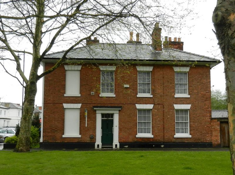
SOUTH STREET
1.
5170
No 16
SK 3436 5/282
II
GV
2.
Brick elevation, return of No 12 Vernon Street (qv). Circa 1840; 2 storeys; 4
sash windows with rusticated stucco lintels; plain doorway; bold lined eaves; hipped
slate roof.
No 16 forms a group with Nos 12 to 18 (consec) Vernon Street and No 29 York Street.
Listing NGR: SK3434836389
External links are from the relevant listing authority and, where applicable, Wikidata. Wikidata IDs may be related buildings as well as this specific building. If you want to add or update a link, you will need to do so by editing the Wikidata entry.


Other nearby listed buildings