Latitude: 51.2308 / 51°13'50"N
Longitude: -0.3329 / 0°19'58"W
OS Eastings: 516495
OS Northings: 149275
OS Grid: TQ164492
Mapcode National: GBR HGJ.LPX
Mapcode Global: VHGS7.5BWB
Plus Code: 9C3X6MJ8+8R
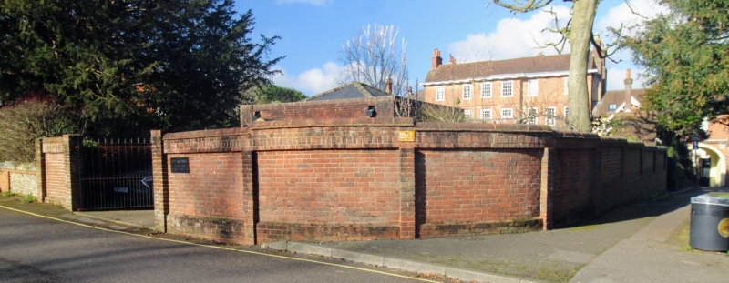
Entry Name: Garden Wall on South East Side of Rose Hill House
Listing Date: 11 June 1973
Grade: II
Source: Historic England
Source ID: 1229582
English Heritage Legacy ID: 404366
ID on this website: 101229582
Location: Rose Hill, Mole Valley, Surrey, RH4
County: Surrey
District: Mole Valley
Electoral Ward/Division: Dorking South
Parish: Non Civil Parish
Built-Up Area: Dorking
Traditional County: Surrey
Lieutenancy Area (Ceremonial County): Surrey
Church of England Parish: Dorking St Paul
Church of England Diocese: Guildford
Tagged with: Wall
ROSE HILL 1. 1049 Garden Wall on South-East side of Rose Hill House TQ 1649 SW 4/28B
II
2. Garden wall of lower height on south-east side of Rose Hill House; mainly of brick with brick pilasters and coping. Small part of wall at south-east end of flint.
Listing NGR: TQ1649549275
External links are from the relevant listing authority and, where applicable, Wikidata. Wikidata IDs may be related buildings as well as this specific building. If you want to add or update a link, you will need to do so by editing the Wikidata entry.


Other nearby listed buildings