Latitude: 53.7324 / 53°43'56"N
Longitude: -1.9841 / 1°59'2"W
OS Eastings: 401148
OS Northings: 426225
OS Grid: SE011262
Mapcode National: GBR GTL8.7R
Mapcode Global: WHB8F.HGF0
Plus Code: 9C5WP2J8+X9
Entry Name: Rochdale Canal Redacre Bridge
Listing Date: 21 June 1984
Grade: II
Source: Historic England
Source ID: 1230190
English Heritage Legacy ID: 405058
ID on this website: 101230190
Location: Mytholmroyd, Calderdale, West Yorkshire, HX7
County: Calderdale
Civil Parish: Hebden Royd
Built-Up Area: Mytholmroyd
Traditional County: Yorkshire
Lieutenancy Area (Ceremonial County): West Yorkshire
Church of England Parish: Mytholmroyd
Church of England Diocese: Leeds
Tagged with: Bridge
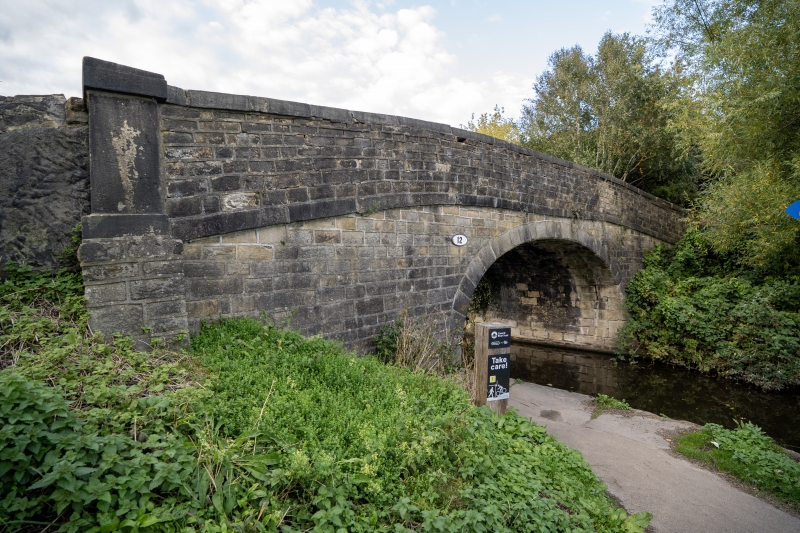
HEBDEN ROYD C.P. ROCHDALE CANAL SE 02NW 2/226 Redacre Bridge G.V. II Bridge, c.1800. Hammer dressed stone supporting walls. Dressed stone voussoirs to single horse-shoe elliptical arch. Dressed stone parapet with cappings and projecting buttressed piers to either end.
Listing NGR: SE0114826225
External links are from the relevant listing authority and, where applicable, Wikidata. Wikidata IDs may be related buildings as well as this specific building. If you want to add or update a link, you will need to do so by editing the Wikidata entry.
Other nearby listed buildings