Approximate Location Map
Large Map »
Latitude: 53.1379 / 53°8'16"N
Longitude: -2.7432 / 2°44'35"W
OS Eastings: 350378
OS Northings: 360339
OS Grid: SJ503603
Mapcode National: GBR 7J.6654
Mapcode Global: WH88P.TDW8
Plus Code: 9C5V47Q4+5P
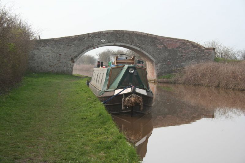
Entry Name: Dutton's Bridge
Listing Date: 19 June 1984
Grade: II
Source: Historic England
Source ID: 1230413
English Heritage Legacy ID: 405162
ID on this website: 101230413
Location: Newton, Cheshire West and Chester, Cheshire, CH3
County: Cheshire West and Chester
Civil Parish: Hargrave and Huxley
Traditional County: Cheshire
Lieutenancy Area (Ceremonial County): Cheshire
Church of England Parish: Tattenhall St Alban
Church of England Diocese: Chester
Tagged with: Bridge
SJ 56 SW NEWTON-BY-TATTENHALL C.P.
3/88 Dutton's Bridge
II
Canal accommodation bridge: c.1779 for Chester Canal Company. Washed
orange brick. Segmental arch sprung from stone imposts with a stone
band above. Curving wing walls, plain parapet and flat stone coping.
An unaltered standard bridge on this canal.
Listing NGR: SJ5037860339
External links are from the relevant listing authority and, where applicable, Wikidata. Wikidata IDs may be related buildings as well as this specific building. If you want to add or update a link, you will need to do so by editing the Wikidata entry.


Other nearby listed buildings
