Latitude: 50.8507 / 50°51'2"N
Longitude: -1.2348 / 1°14'5"W
OS Eastings: 453960
OS Northings: 105965
OS Grid: SU539059
Mapcode National: GBR 9B0.LMR
Mapcode Global: FRA 869V.GR7
Plus Code: 9C2WVQ28+73
Entry Name: 5 and 7, High Street
Listing Date: 11 September 1974
Grade: II
Source: Historic England
Source ID: 1230514
English Heritage Legacy ID: 141646
ID on this website: 101230514
Location: Titchfield, Fareham, Hampshire, PO14
County: Hampshire
District: Fareham
Electoral Ward/Division: Titchfield
Parish: Non Civil Parish
Built-Up Area: Locks Heath/Warsash/Whiteley
Traditional County: Hampshire
Lieutenancy Area (Ceremonial County): Hampshire
Church of England Parish: Titchfield St Peter
Church of England Diocese: Portsmouth
Tagged with: Building
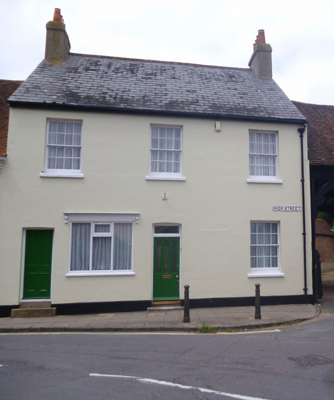
HIGH STREET 1. 5231 (West Side) Titchfield Nos 5 and 7 SU 5305 6/451 11.9.74. II GV 2. Late C18/early C19 house. Rendered facade with steeply pitched slate roof. End chimneys with some Fareham Chimney Pots. 2 storeys. 3 windows, these of lst floor barred sashes, ground floor altered later in C19. 2 doors and 2 windows including earlier C19 small shop window with cornice above; both windows boarded up. Rear has tiled roof. 2 1/2 storeys. 2 dormers and 3 windows including centre lst floor blank. Prominent position at junction of High Street and East Street, facing straight down East Street. Nos 3 to 39 (odd) and Old Clarendon House, form a group with Nos 2, 6 and 8, Nos 14 to 18 (even) Nos 22 to 26 (even) Rockstone House and Nos 5 to 11 (odd) the Old Lodge and Old Lodge Cottage High Street, Titchfield (Nos 14 to 18 (even) and Nos 22 to 26 (even) are builsingds of local interest).
Listing NGR: SU5396005965
External links are from the relevant listing authority and, where applicable, Wikidata. Wikidata IDs may be related buildings as well as this specific building. If you want to add or update a link, you will need to do so by editing the Wikidata entry.


Other nearby listed buildings