Approximate Location Map
Large Map »
Latitude: 53.6312 / 53°37'52"N
Longitude: -1.7451 / 1°44'42"W
OS Eastings: 416953
OS Northings: 414994
OS Grid: SE169149
Mapcode National: GBR JV7G.Z1
Mapcode Global: WHCB2.5Z8M
Plus Code: 9C5WJ7J3+FX
Entry Name: 31, St Helens Gate
Listing Date: 29 September 1978
Grade: II
Source: Historic England
Source ID: 1231787
English Heritage Legacy ID: 407026
ID on this website: 101231787
Location: Almondbury, Kirklees, West Yorkshire, HD4
County: Kirklees
Electoral Ward/Division: Almondbury
Parish: Non Civil Parish
Built-Up Area: Huddersfield
Traditional County: Yorkshire
Lieutenancy Area (Ceremonial County): West Yorkshire
Church of England Parish: Almondbury with Farnley Tyas Team Parish
Church of England Diocese: Leeds
Tagged with: Building
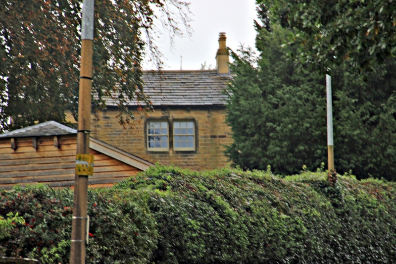
ST HELEN'S GATE
1.
5113
(West Side)
Almondbury
No 31
SE 1614 45/1165
II
2.
Early or mid C19. Hammer dressed stone. Pitched stone slate. 2 storeys.
3 ranges of bipartite sashes with glazing bars. Door with Tuscan frame and
cornice. Similar door to street with fanlight and glazing bars.
Listing NGR: SE1695114988
External links are from the relevant listing authority and, where applicable, Wikidata. Wikidata IDs may be related buildings as well as this specific building. If you want to add or update a link, you will need to do so by editing the Wikidata entry.


Other nearby listed buildings
