Latitude: 53.3492 / 53°20'57"N
Longitude: -2.0143 / 2°0'51"W
OS Eastings: 399143
OS Northings: 383593
OS Grid: SJ991835
Mapcode National: GBR GYCQ.P3
Mapcode Global: WHBBC.122R
Plus Code: 9C5V8XXP+M7
Entry Name: Barn at Red Moor Farm
Listing Date: 17 November 1983
Grade: II
Source: Historic England
Source ID: 1231808
English Heritage Legacy ID: 406859
ID on this website: 101231808
Location: Lane Ends, Cheshire East, Cheshire, SK12
County: Cheshire East
Civil Parish: Disley
Traditional County: Cheshire
Lieutenancy Area (Ceremonial County): Cheshire
Church of England Parish: Disley St Mary
Church of England Diocese: Chester
Tagged with: Barn
SJ 98 SE DISLEY C.P. REDMOOR LANE (East Side)
4/49 Barn at Red Moor Farm
II
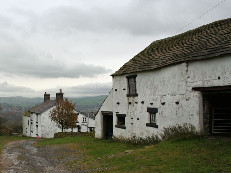
Barn: C17 with C19 alterations. White-washed and rendered buff sandstone rubble with projecting through stones. Kerridge stone-slate roof and stone ridge. Long, rectangular downhill plan with outshut at downhill end. Upper part corn barn with opposed entrances under massive wooden lintel to rear and C20 steel beam in front. Lower end shippon with loft above with 3 C19 openings with hammer-dressed lintels. Interior: 3 original roof trusses, with arched braces on tie beams and overlapping through purlins.
Listing NGR: SJ9914383593
External links are from the relevant listing authority and, where applicable, Wikidata. Wikidata IDs may be related buildings as well as this specific building. If you want to add or update a link, you will need to do so by editing the Wikidata entry.


Other nearby listed buildings