Latitude: 51.3524 / 51°21'8"N
Longitude: -0.251 / 0°15'3"W
OS Eastings: 521892
OS Northings: 162934
OS Grid: TQ218629
Mapcode National: GBR 9X.MD2
Mapcode Global: VHGRP.L8PL
Plus Code: 9C3X9P2X+XJ
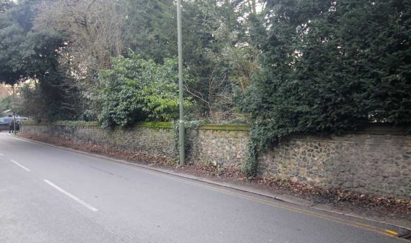
Entry Name: Wall to Garden of Upper Mill, from Corner of Chessington Road to Gates to Upper Mill
Listing Date: 22 March 1974
Grade: II
Source: Historic England
Source ID: 1231862
English Heritage Legacy ID: 400043
ID on this website: 101231862
Location: Ewell, Epsom and Ewell, Surrey, KT17
County: Surrey
District: Epsom and Ewell
Electoral Ward/Division: Ewell
Parish: Non Civil Parish
Built-Up Area: Ewell
Traditional County: Surrey
Lieutenancy Area (Ceremonial County): Surrey
Church of England Parish: Ewell St Mary the Virgin
Church of England Diocese: Guildford
Tagged with: Wall
EWELL 1. 1086 KINGSTON ROAD (West Side) Wall to garden of Upper Mill, from corner of Chessington Road to gates to Upper Mill TQ 2162 21/329 II
2. Probably C19. Nodular flint, partly coursed. Brick coping with modillions.
Listing NGR: TQ2189262934
External links are from the relevant listing authority and, where applicable, Wikidata. Wikidata IDs may be related buildings as well as this specific building. If you want to add or update a link, you will need to do so by editing the Wikidata entry.


Other nearby listed buildings