Latitude: 53.3268 / 53°19'36"N
Longitude: -2.0249 / 2°1'29"W
OS Eastings: 398435
OS Northings: 381100
OS Grid: SJ984811
Mapcode National: GBR GY9Z.D4
Mapcode Global: WHBBB.VMXY
Plus Code: 9C5V8XGG+P2
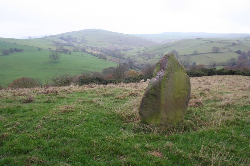
Entry Name: Standing Stone 170 Metres, North West of Cornfields Farm
Listing Date: 17 November 1983
Grade: II
Source: Historic England
Source ID: 1232106
English Heritage Legacy ID: 407427
ID on this website: 101232106
Location: Cheshire East, Cheshire, SK23
County: Cheshire East
Civil Parish: Lyme Handley
Traditional County: Cheshire
Lieutenancy Area (Ceremonial County): Cheshire
Church of England Parish: Disley St Mary
Church of England Diocese: Chester
SJ 98 SE
4/85
LYME HANDLEY C.P.
Standing stone 170m, north-west of Cornfields Farm.
II
Standing stone: Bronze Age. Sub-triangular sandstone block standing
c. 1.20m high on top of a long low hill and visible for some distance
on 3 sides of the compass.
Listing NGR: SJ 98435 81100


Other nearby listed buildings