Latitude: 51.3349 / 51°20'5"N
Longitude: -0.2643 / 0°15'51"W
OS Eastings: 521010
OS Northings: 160968
OS Grid: TQ210609
Mapcode National: GBR 93.Q1R
Mapcode Global: VHGRP.CQM0
Plus Code: 9C3X8PMP+X7
Entry Name: Former National School Society School
Listing Date: 24 June 1976
Grade: II
Source: Historic England
Source ID: 1232223
English Heritage Legacy ID: 407558
ID on this website: 101232223
Location: Epsom, Epsom and Ewell, Surrey, KT19
County: Surrey
District: Epsom and Ewell
Electoral Ward/Division: Town
Parish: Non Civil Parish
Built-Up Area: Epsom
Traditional County: Surrey
Lieutenancy Area (Ceremonial County): Surrey
Church of England Parish: Epsom St Martin
Church of England Diocese: Guildford
Tagged with: School building
This list entry was subject to a Minor Amendment on 30 April 2025 to update the Name and Address and reformat the text to current standards
TQ 2060
30/378
TQ 2160
50/3?8
EPSOM
HOOK ROAD (West Side)
No 1A (Former National School Society School)
(Formerly listed as Hook Road School)
II
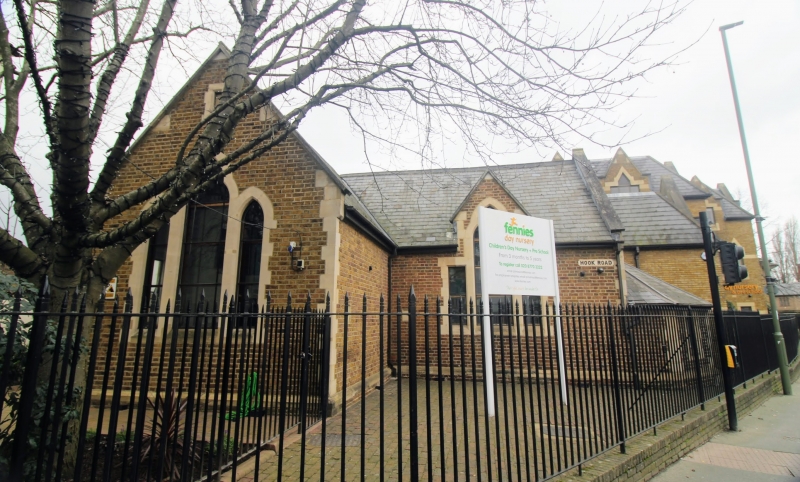
C1837-1840. (Appears on 1843 Tithe map, and on 1847 Report on Epsom Water and Sewerage is described as about ten years old). An early National School Society School. Yellow brick. Ashlar dressings. Pitched slate roof. Coped gable ends on kneelers. One storey. L-shaped plan. South wing has triple lancet with glazing bars with plain chamfered surrounds.
East wing has single lancet with oblong flanking lights, surmounted by coped gable on kneelers.
One storey extension to east with hipped roof and oblong window. Buttress and porch on west side.
Listing NGR: TQ2101060968
External links are from the relevant listing authority and, where applicable, Wikidata. Wikidata IDs may be related buildings as well as this specific building. If you want to add or update a link, you will need to do so by editing the Wikidata entry.


Other nearby listed buildings