Latitude: 54.9869 / 54°59'12"N
Longitude: -1.4228 / 1°25'22"W
OS Eastings: 437032
OS Northings: 565963
OS Grid: NZ370659
Mapcode National: GBR LBHS.R4
Mapcode Global: WHD4S.3XRC
Plus Code: 9C6WXHPG+QV
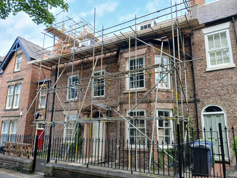
Entry Name: 5, Westoe Village
Listing Date: 1 February 1983
Grade: II
Source: Historic England
Source ID: 1232328
English Heritage Legacy ID: 407689
ID on this website: 101232328
Location: Westoe, South Tyneside, Tyne and Wear, NE33
County: South Tyneside
Electoral Ward/Division: Westoe
Parish: Non Civil Parish
Built-Up Area: South Shields
Traditional County: Durham
Lieutenancy Area (Ceremonial County): Tyne and Wear
Church of England Parish: South Westoe
Church of England Diocese: Durham
Tagged with: Building
1.
5102
NZ 3765 NW
11/75
WESTOE VILLAGE
(north side)
No 5
II
GV
2.
Circa 1788.
Red brick, slate roof. Two storeys, 3 bays, stone heads. Two storeyed bay window
to the east bay. All windows sashed, with glazing bars. Fine Tuscan doorcase
(half columns) with broken pediment, good fanlight. Brick string course above the
ground floor and first floor window heads.
Listing NGR: NZ3703265963
External links are from the relevant listing authority and, where applicable, Wikidata. Wikidata IDs may be related buildings as well as this specific building. If you want to add or update a link, you will need to do so by editing the Wikidata entry.


Other nearby listed buildings