Approximate Location Map
Large Map »
Latitude: 50.8681 / 50°52'5"N
Longitude: -0.783 / 0°46'58"W
OS Eastings: 485738
OS Northings: 108326
OS Grid: SU857083
Mapcode National: GBR DGD.DVY
Mapcode Global: FRA 967T.4SG
Plus Code: 9C2XV698+6R
Entry Name: Rook's Hill
Listing Date: 28 January 1986
Grade: II
Source: Historic England
Source ID: 1232424
English Heritage Legacy ID: 300944
ID on this website: 101232424
Location: Mid Lavant, Chichester, West Sussex, PO18
County: West Sussex
District: Chichester
Civil Parish: Lavant
Built-Up Area: Mid Lavant
Traditional County: Sussex
Lieutenancy Area (Ceremonial County): West Sussex
Church of England Parish: Lavant St Mary
Church of England Diocese: Chichester
Tagged with: Architectural structure
LAVANT CHICHESTER ROAD (west side)
SU 8408-85O8 MID LAVANT
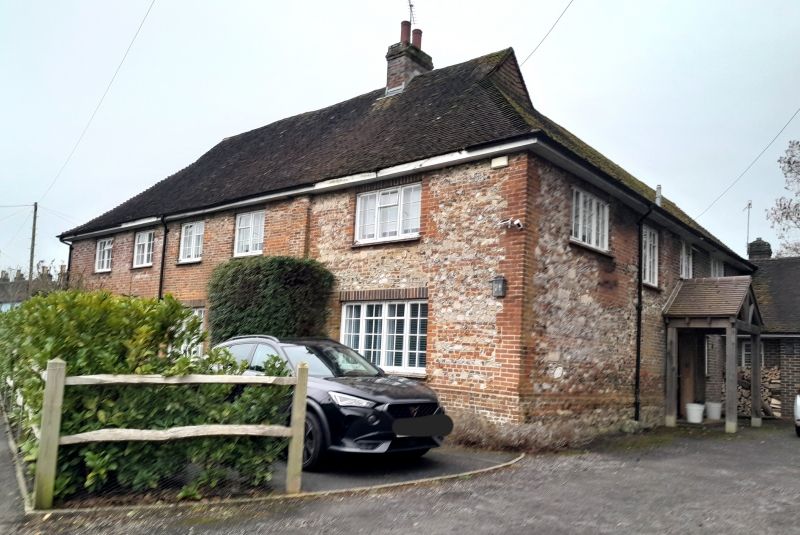
38/346 Rook's Hill
-
- II
C18 or earlier house, restored. Two storeys. Five windows. Red brick with
some flints. Eaves cornice. Hipped tiled roof. Modern casement windows.
Listing NGR: SU8573808326
External links are from the relevant listing authority and, where applicable, Wikidata. Wikidata IDs may be related buildings as well as this specific building. If you want to add or update a link, you will need to do so by editing the Wikidata entry.


Other nearby listed buildings
