Approximate Location Map
Large Map »
Latitude: 50.981 / 50°58'51"N
Longitude: 0.4314 / 0°25'52"E
OS Eastings: 570768
OS Northings: 122995
OS Grid: TQ707229
Mapcode National: GBR NT8.FWL
Mapcode Global: FRA C6SJ.9VB
Plus Code: 9F22XCJJ+CH
Entry Name: Newhouse Farmhouse
Listing Date: 13 May 1987
Grade: II
Source: Historic England
Source ID: 1232441
English Heritage Legacy ID: 292452
ID on this website: 101232441
Location: Rother, East Sussex, TN32
County: East Sussex
District: Rother
Civil Parish: Brightling
Traditional County: Sussex
Lieutenancy Area (Ceremonial County): East Sussex
Church of England Parish: Brightling St Thomas a Becket
Church of England Diocese: Chichester
Tagged with: Farmhouse
TQ 72 SW
12/13
BRIGHTLING
ROBERTSBRIDGE ROAD
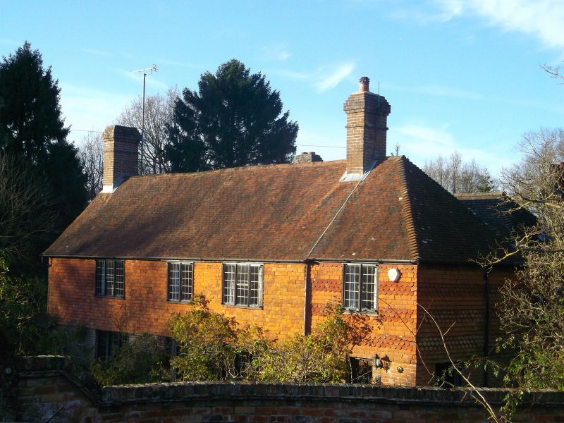
Newhouse Farmhouse
II
C18. Two storeys. Three windows. Ground floor red brick, above tile-hung. Tiled
roof. Casement windows.
Listing NGR: TQ7076822995
External links are from the relevant listing authority and, where applicable, Wikidata. Wikidata IDs may be related buildings as well as this specific building. If you want to add or update a link, you will need to do so by editing the Wikidata entry.


Other nearby listed buildings
