Latitude: 50.8423 / 50°50'32"N
Longitude: -0.6612 / 0°39'40"W
OS Eastings: 494358
OS Northings: 105604
OS Grid: SU943056
Mapcode National: GBR FJ8.1ND
Mapcode Global: FRA 96HW.471
Plus Code: 9C2XR8RQ+WG
Entry Name: Argyl House
Listing Date: 20 September 1984
Grade: II
Source: Historic England
Source ID: 1232582
English Heritage Legacy ID: 297679
ID on this website: 101232582
Location: Westergate, Arun, West Sussex, PO20
County: West Sussex
District: Arun
Civil Parish: Aldingbourne
Built-Up Area: Westergate
Traditional County: Sussex
Lieutenancy Area (Ceremonial County): West Sussex
Church of England Parish: Aldingbourne, Barnham and Eastergate
Church of England Diocese: Chichester
Tagged with: House
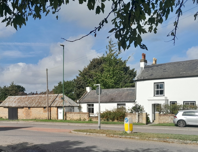
SU 90 NW ALDINGBOURNE NYTON ROAD, EASTERGATE
7/452
Argyl House
GV
II
Early C19. Two storeys. Two windows. Glazing bars missing. Porch of solid type.
Ground floor wing of two windows to west. This building forms part of a Group with
Elm Tree Stores, Shelley House, The White House, Flint House and Nos 1-3 Malthouse
Cottages.
Listing NGR: SU9435805604
External links are from the relevant listing authority and, where applicable, Wikidata. Wikidata IDs may be related buildings as well as this specific building. If you want to add or update a link, you will need to do so by editing the Wikidata entry.


Other nearby listed buildings