Approximate Location Map
Large Map »
Latitude: 50.9661 / 50°57'57"N
Longitude: -0.884 / 0°53'2"W
OS Eastings: 478464
OS Northings: 119110
OS Grid: SU784191
Mapcode National: GBR CCR.CBS
Mapcode Global: FRA 961K.7G4
Plus Code: 9C2XX488+CC
Entry Name: The Engine House at Engine Farm to the West of the Farmhouse
Listing Date: 26 November 1987
Grade: II
Source: Historic England
Source ID: 1233408
English Heritage Legacy ID: 301856
ID on this website: 101233408
Location: South Harting, Chichester, West Sussex, GU31
County: West Sussex
District: Chichester
Civil Parish: Harting
Built-Up Area: South Harting
Traditional County: Sussex
Lieutenancy Area (Ceremonial County): West Sussex
Church of England Parish: Harting St Mary and St Gabriel
Church of England Diocese: Chichester
Tagged with: Agricultural structure
SU 7819-7919 HARTING THE STREET (east side)
South Harting
28/11 The Engine House at Engine
Farm to the west of the
- farmhouse
- II
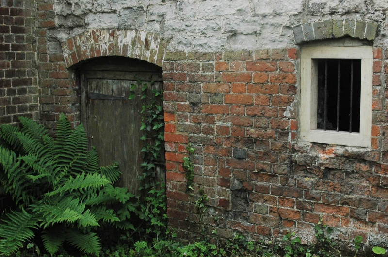
Small square building. C18. Stone. Eaves cornice of three courses of oversailing
red bricks. Hipped tiled roof with stone ball cap at apex. Small iron water-wheel
inside.
Listing NGR: SU7846419110
External links are from the relevant listing authority and, where applicable, Wikidata. Wikidata IDs may be related buildings as well as this specific building. If you want to add or update a link, you will need to do so by editing the Wikidata entry.


Other nearby listed buildings
