Latitude: 51.1845 / 51°11'4"N
Longitude: 0.9308 / 0°55'50"E
OS Eastings: 604921
OS Northings: 146894
OS Grid: TR049468
Mapcode National: GBR SXQ.N4W
Mapcode Global: VHKKH.2HY9
Plus Code: 9F325WMJ+R8
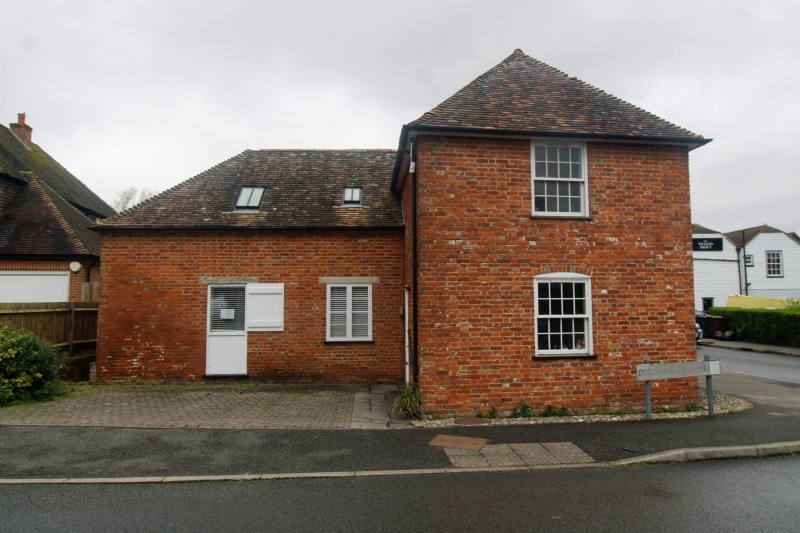
Entry Name: The Granary
Listing Date: 16 February 1989
Grade: II
Source: Historic England
Source ID: 1234207
English Heritage Legacy ID: 410050
ID on this website: 101234207
Location: Wye, Ashford, Kent, TN25
County: Kent
District: Ashford
Civil Parish: Wye with Hinxhill
Built-Up Area: Wye
Traditional County: Kent
Lieutenancy Area (Ceremonial County): Kent
Tagged with: Architectural structure
This list entry was subject to a Minor Amendment on 17 April 2024 to update the name and address and to reformat the text to current standards
TR 0446 0546
8/196
WYE
BRIDGE STREET (south side)
The Granary
(Formerly listed as Storage out-houses, about 50 metres north-east of the Mill House)
GV
II
Storage buildings, part of mill complex. C18. Red brick, part painted, with plain tiled roof. Two storey block to right, weather boarded on first floor, with hipped roof. Glazing bar sash on first floor, sliding carriage doors on ground floor. Loft door on left return, and glazed barred light to rear. Single storey hipped range to right, with two wooden casements and half-door to right. (Former carthouse and stable to adjacent mill complex?) Included for group value.
Listing NGR: TR0492146894
External links are from the relevant listing authority and, where applicable, Wikidata. Wikidata IDs may be related buildings as well as this specific building. If you want to add or update a link, you will need to do so by editing the Wikidata entry.


Other nearby listed buildings