Approximate Location Map
Large Map »
Latitude: 53.6121 / 53°36'43"N
Longitude: -1.9107 / 1°54'38"W
OS Eastings: 406005
OS Northings: 412837
OS Grid: SE060128
Mapcode National: GBR HV3N.4X
Mapcode Global: WHB91.MGCS
Plus Code: 9C5WJ36Q+RP
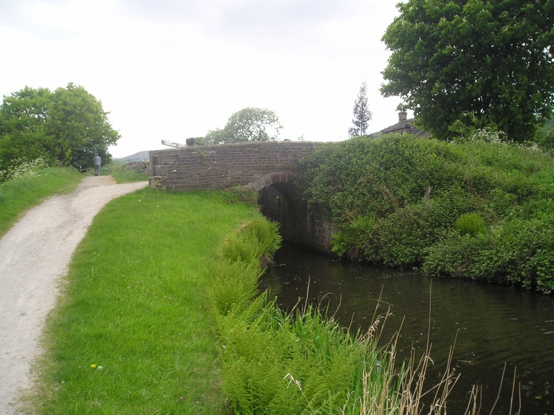
Entry Name: Huddersfield Narrow Canal; Booths Bridge
Listing Date: 11 July 1985
Grade: II
Source: Historic England
Source ID: 1234421
English Heritage Legacy ID: 410323
ID on this website: 101234421
Location: Booth, Kirklees, West Yorkshire, HD7
County: Kirklees
Electoral Ward/Division: Colne Valley
Parish: Non Civil Parish
Traditional County: Yorkshire
Lieutenancy Area (Ceremonial County): West Yorkshire
Church of England Parish: Slaithwaite with East Scammonden St James
Church of England Diocese: Leeds
Tagged with: Bridge
SE 060128 HUDDERSFIELD NARROW CANAL
5/190 Booth's Bridge
-
- II
1794-8. Engineer probably Benjamin Outram. Hammer dressed stone. Round
arched bridge with slightly pronounced string course at base of parapets.
Large copings with rounded tops.
Listing NGR: SE0600512837
External links are from the relevant listing authority and, where applicable, Wikidata. Wikidata IDs may be related buildings as well as this specific building. If you want to add or update a link, you will need to do so by editing the Wikidata entry.


Other nearby listed buildings
