Latitude: 55.617 / 55°37'1"N
Longitude: -1.6556 / 1°39'20"W
OS Eastings: 421791
OS Northings: 635986
OS Grid: NU217359
Mapcode National: GBR J3WH.C9
Mapcode Global: WHC0M.J2VS
Plus Code: 9C7WJ88V+QQ
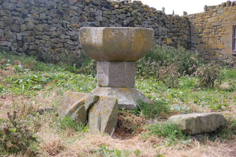
Entry Name: Font Circa 10 Yards South West of Chapel of St Cuthbert
Listing Date: 22 December 1969
Grade: II
Source: Historic England
Source ID: 1234538
English Heritage Legacy ID: 410371
ID on this website: 101234538
Location: Northumberland, NE68
County: Northumberland
Civil Parish: North Sunderland
Lieutenancy Area (Ceremonial County): Northumberland
Tagged with: Baptismal font
NORTH SUNDERLAND INNER FARNE NU 23 NW Farne Islands 5/174 Font c.10 yards south-west of 22.12.69 Chapel of St. Cuthbert GV II Font. Probably late C15. Sandstone. Octagonal base and octagonal bowl with slightly concave sides.
Listing NGR: NU2179135986
External links are from the relevant listing authority and, where applicable, Wikidata. Wikidata IDs may be related buildings as well as this specific building. If you want to add or update a link, you will need to do so by editing the Wikidata entry.


Other nearby listed buildings