Approximate Location Map
Large Map »
Latitude: 50.9821 / 50°58'55"N
Longitude: 0.7315 / 0°43'53"E
OS Eastings: 591828
OS Northings: 123849
OS Grid: TQ918238
Mapcode National: GBR QX9.CRY
Mapcode Global: FRA D6FJ.0SS
Plus Code: 9F22XPJJ+RH
Entry Name: The Old Bakery
Listing Date: 13 May 1987
Grade: II
Source: Historic England
Source ID: 1234757
English Heritage Legacy ID: 410806
ID on this website: 101234757
Location: Iden, Rother, East Sussex, TN31
County: East Sussex
District: Rother
Civil Parish: Iden
Built-Up Area: Iden
Traditional County: Sussex
Lieutenancy Area (Ceremonial County): East Sussex
Church of England Parish: Iden All Saints
Church of England Diocese: Chichester
Tagged with: Architectural structure
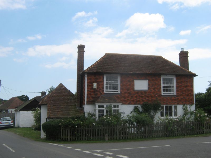
TQ 9023-9123 IDEN MAIN STREET
(east side)
50/10 The Old Bakery
GV II
C18. Two storeys. Two windows. Painted brick on ground gloor above tile-hung, both now
painted. Hipped tiled roof. Casement windows on ground floor, sashes with glazing
bars above.
Listing NGR: TQ9182823849
External links are from the relevant listing authority and, where applicable, Wikidata. Wikidata IDs may be related buildings as well as this specific building. If you want to add or update a link, you will need to do so by editing the Wikidata entry.


Other nearby listed buildings
