Approximate Location Map
Large Map »
Latitude: 51.2975 / 51°17'51"N
Longitude: 0.3798 / 0°22'47"E
OS Eastings: 566012
OS Northings: 158069
OS Grid: TQ660580
Mapcode National: GBR NPB.LVC
Mapcode Global: VHJM4.JNN5
Plus Code: 9F3279XH+2W
Entry Name: Chest Tomb 10 Yards West of Offham Church
Listing Date: 30 May 1984
Grade: II
Source: Historic England
Source ID: 1236025
English Heritage Legacy ID: 426938
ID on this website: 101236025
Location: St Michael's Church, Offham, Tonbridge and Malling, Kent, ME19
County: Kent
District: Tonbridge and Malling
Civil Parish: Offham
Traditional County: Kent
Lieutenancy Area (Ceremonial County): Kent
Church of England Parish: Offham St Michael
Church of England Diocese: Rochester
Tagged with: Chest tomb
TQ 65 NE OFFHAM C.P. CHURCH ROAD
6/4 (west side)
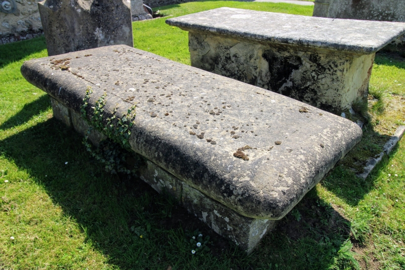
Chest tomb 10 yards
west of Offham Church
GV
II
Chest tomb. Circa 1700. Stone. Very low. Inscription illegible.
Listing NGR: TQ6601258069
External links are from the relevant listing authority and, where applicable, Wikidata. Wikidata IDs may be related buildings as well as this specific building. If you want to add or update a link, you will need to do so by editing the Wikidata entry.


Other nearby listed buildings
