Approximate Location Map
Large Map »
Latitude: 51.3365 / 51°20'11"N
Longitude: 0.3028 / 0°18'10"E
OS Eastings: 560508
OS Northings: 162226
OS Grid: TQ605622
Mapcode National: GBR Y7.P03
Mapcode Global: VHHPG.6NGT
Plus Code: 9F3288P3+H4
Entry Name: The Old Rectory
Listing Date: 30 May 1984
Grade: II
Source: Historic England
Source ID: 1236111
English Heritage Legacy ID: 427033
ID on this website: 101236111
Location: Stansted, Tonbridge and Malling, Kent, TN15
County: Kent
District: Tonbridge and Malling
Civil Parish: Stansted
Traditional County: Kent
Lieutenancy Area (Ceremonial County): Kent
Church of England Parish: Stansted St Mary
Church of England Diocese: Rochester
Tagged with: Clergy house
TQ 66 SW STANSTED PLAXDALE GREEN ROAD
2/3 (north side)
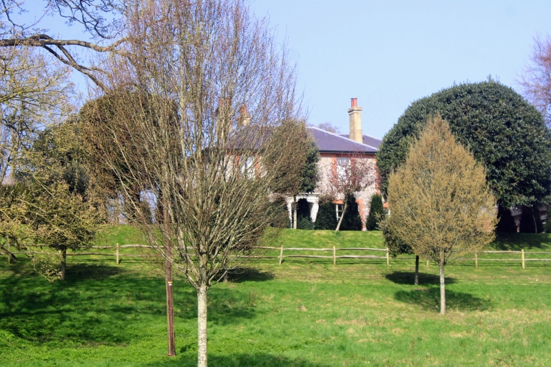
The Old Rectory
II
House. Circa 1840. Flint rubble with red brick quoins and dressings. Boxed eaves
to low pitched slate roof with end stacks. 2 storeys; 3 windows, glazing bar sashes
on ground-floor tripartite. Central projecting porch with panelled door.
Listing NGR: TQ6050862226
External links are from the relevant listing authority and, where applicable, Wikidata. Wikidata IDs may be related buildings as well as this specific building. If you want to add or update a link, you will need to do so by editing the Wikidata entry.


Other nearby listed buildings
