Latitude: 50.4308 / 50°25'50"N
Longitude: -3.6916 / 3°41'29"W
OS Eastings: 279951
OS Northings: 60359
OS Grid: SX799603
Mapcode National: GBR QL.MC9G
Mapcode Global: FRA 374X.CMM
Plus Code: 9C2RC8J5+89
Entry Name: 101, High Street
Listing Date: 25 March 1969
Grade: II
Source: Historic England
Source ID: 1236268
English Heritage Legacy ID: 427218
ID on this website: 101236268
Location: Totnes, South Hams, Devon, TQ9
County: Devon
District: South Hams
Civil Parish: Totnes
Built-Up Area: Totnes
Traditional County: Devon
Lieutenancy Area (Ceremonial County): Devon
Church of England Parish: Totnes St Mary
Church of England Diocese: Exeter
Tagged with: Building
1. 5180 HIGH STREET No 101 SX 7960 SE 1/120A 25.3.69.
II GV
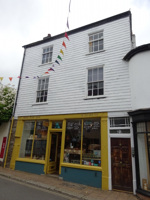
2. Early C19. 3 storeys. 2 windows. Hipped Welsh slate roof. Rendered stack. Slate-hung front with plain eaves band. Architraved sash windows, 2nd floor with glazing bars. Wooden double shopfront with pilasters carrying entablature with projecting cornice. Altered shop windows and doorway.
Listing NGR: SX7995160359
External links are from the relevant listing authority and, where applicable, Wikidata. Wikidata IDs may be related buildings as well as this specific building. If you want to add or update a link, you will need to do so by editing the Wikidata entry.


Other nearby listed buildings