Latitude: 50.4314 / 50°25'52"N
Longitude: -3.6871 / 3°41'13"W
OS Eastings: 280271
OS Northings: 60417
OS Grid: SX802604
Mapcode National: GBR QM.T6FN
Mapcode Global: FRA 375X.7DS
Plus Code: 9C2RC8J7+G5
Entry Name: Eastgate House
Listing Date: 7 January 1952
Grade: II*
Source: Historic England
Source ID: 1236273
English Heritage Legacy ID: 427223
ID on this website: 101236273
Location: Totnes, South Hams, Devon, TQ9
County: Devon
District: South Hams
Civil Parish: Totnes
Built-Up Area: Totnes
Traditional County: Devon
Lieutenancy Area (Ceremonial County): Devon
Church of England Parish: Totnes St Mary
Church of England Diocese: Exeter
Tagged with: House
1. 5180 HIGH STREET (South Side) No 2 (Eastgate House) SX 8060 SW 1/98 7.1.52.
II* GV
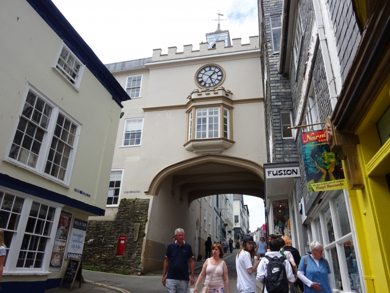
2. Probably refronted circa 1835 at the same time as the Eastgate was rebuilt (qv). The site of the principal inn of Totnes known as the King's Arms: renamed the King's Head in 1642. In 1762 known as the Angel Inn with 4 parlours, a large dining room that extended across the street, 15 lodging rooms, 2 kitchens, a coach house and stabling for upwards of 40 horses. In 1824 a ballroom was built at the rear. In 1850 Lord Seymour purchased the building and opened it as a Mechanic's Institute and Reading Room. Latterly the Berry Pomeroy estate office. 3 storeys. 3 windows. Hipped Welsh slate roof. Stucco front with boxed-out wooden eaves cornice. Plinth. Architraved sash with glazing bars. Round-arched staircase window with radial glazing and margin lights. Round-arched, architraved doorway with radial fanlight and raised and fielded panel door. Interior with geometrical staircase and bracketed cornice to hall of 1835. At the rear the former ballroom of 1824 has a hipped Welsh slate roof with projecting eaves and slate-hung walls: interior of ballroom with moulded plaster cornice and ceiling rose; chimneypiece with good hob grate. The east return to South Street incorporates at ground floor level the battered base of the medieval town wall in coursed Devonian limestone rubble. Grade II* for group value. (M. Laithwaite).
Listing NGR: SX8027160417
External links are from the relevant listing authority and, where applicable, Wikidata. Wikidata IDs may be related buildings as well as this specific building. If you want to add or update a link, you will need to do so by editing the Wikidata entry.


Other nearby listed buildings