Latitude: 52.0588 / 52°3'31"N
Longitude: 1.1589 / 1°9'31"E
OS Eastings: 616648
OS Northings: 244760
OS Grid: TM166447
Mapcode National: GBR TMP.ZRV
Mapcode Global: VHLBT.1JH1
Plus Code: 9F433555+GG
Entry Name: 14, St Margaret's Green
Listing Date: 15 December 1977
Grade: II
Source: Historic England
Source ID: 1236860
English Heritage Legacy ID: 427971
ID on this website: 101236860
Location: Ipswich, Suffolk, IP4
County: Suffolk
District: Ipswich
Electoral Ward/Division: St Margaret's
Parish: Non Civil Parish
Built-Up Area: Ipswich
Traditional County: Suffolk
Lieutenancy Area (Ceremonial County): Suffolk
Church of England Parish: Ipswich St Margaret
Church of England Diocese: St.Edmundsbury and Ipswich
Tagged with: Building
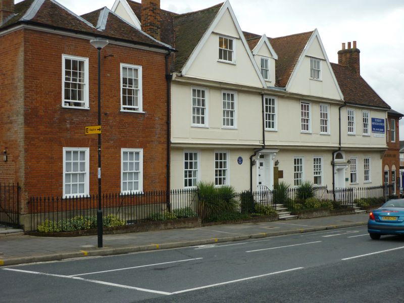
ST MARGARET'S GREEN
1.
5579 (East Side)
No 14
TM 1644 NE 2/473
II GV
2.
An C18 red brick building 2 storeys. 2 window range, double-hung sashes with glazing
bars, in flush cased frames. The ground storey has 1 small modern window. Roof
tiled, hipped and double-pitched on the front.
Listing NGR: TM1664844760
External links are from the relevant listing authority and, where applicable, Wikidata. Wikidata IDs may be related buildings as well as this specific building. If you want to add or update a link, you will need to do so by editing the Wikidata entry.


Other nearby listed buildings