Latitude: 50.4299 / 50°25'47"N
Longitude: -3.684 / 3°41'2"W
OS Eastings: 280486
OS Northings: 60247
OS Grid: SX804602
Mapcode National: GBR QM.T77L
Mapcode Global: FRA 375X.GKV
Plus Code: 9C2RC8H8+X9
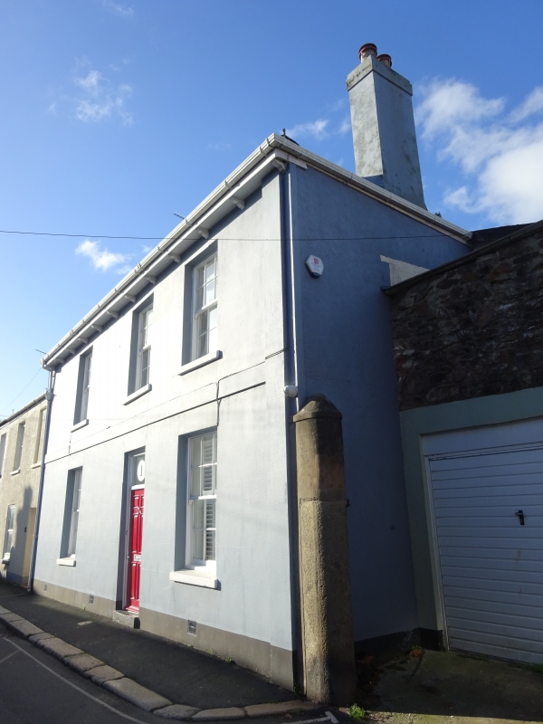
Entry Name: 1, Warland
Listing Date: 16 March 1978
Grade: II
Source: Historic England
Source ID: 1236974
English Heritage Legacy ID: 428099
ID on this website: 101236974
Location: Totnes, South Hams, Devon, TQ9
County: Devon
District: South Hams
Civil Parish: Totnes
Built-Up Area: Totnes
Traditional County: Devon
Lieutenancy Area (Ceremonial County): Devon
Church of England Parish: Totnes St Mary
Church of England Diocese: Exeter
Tagged with: Building
1. 5180 WARLAND (West Side) No 1 SX 8060 SW 2/228
II GV
2. Earlier C19. 2 storeys and dormer. Double fronted with 3 windows. Welsh slate roof with swept projecting eaves carried on brackets. Cement rendered front with plain 1st floor band. Recessed sash windows with glazing bars. Recessed doorway with fanlight and half-glazed door.
Listing NGR: SX8048660246
External links are from the relevant listing authority and, where applicable, Wikidata. Wikidata IDs may be related buildings as well as this specific building. If you want to add or update a link, you will need to do so by editing the Wikidata entry.


Other nearby listed buildings