Latitude: 51.2438 / 51°14'37"N
Longitude: 1.3306 / 1°19'50"E
OS Eastings: 632555
OS Northings: 154679
OS Grid: TR325546
Mapcode National: GBR X1G.TFX
Mapcode Global: VHLGS.0ZSV
Plus Code: 9F3368VJ+G6
Entry Name: Ham Manor
Listing Date: 13 October 1952
Last Amended: 24 March 1987
Grade: II
Source: Historic England
Source ID: 1236992
English Heritage Legacy ID: 428127
ID on this website: 101236992
Location: Ham, Dover, Kent, CT14
County: Kent
District: Dover
Civil Parish: Northbourne
Traditional County: Kent
Lieutenancy Area (Ceremonial County): Kent
Tagged with: Manor house
NORTHBOURNE HAM TR 35 SW
4/13 Ham Manor (formerly listed 13.10.52 as Ham Farmhouse)
GV II
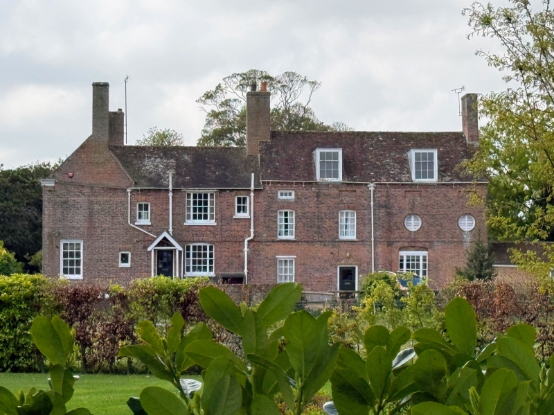
House. C16 extended early C18 and altered early C19. Timber framed and rendered with slate roof and extended with red brick and plain tiled roof to rear. Two storeys on plinth with moulded wooden eaves cornice to roof with large offset and projecting stack at end left and stacks to centre left, end right and rear right. Five glazing bar sashes on first floor and 6 on ground floor with central door of 6 panels with open pedimented surround on pilaster frame. Rear wing of red brick. 2 full storeys and attic with sunk blank panelled mezzanine storey. Two glazing bar sashes and 2 roundels on first floor.
Listing NGR: TR3255554679
External links are from the relevant listing authority and, where applicable, Wikidata. Wikidata IDs may be related buildings as well as this specific building. If you want to add or update a link, you will need to do so by editing the Wikidata entry.


Other nearby listed buildings