Latitude: 51.6596 / 51°39'34"N
Longitude: 0.8259 / 0°49'33"E
OS Eastings: 595551
OS Northings: 199428
OS Grid: TQ955994
Mapcode National: GBR RPF.ZKH
Mapcode Global: VHKH3.8KG3
Plus Code: 9F32MR5G+R9
Entry Name: 41 and 43, Kings Road
Listing Date: 5 August 1986
Grade: II
Source: Historic England
Source ID: 1237479
English Heritage Legacy ID: 428729
ID on this website: 101237479
Location: Southminster, Maldon, Essex, CM0
County: Essex
District: Maldon
Civil Parish: Southminster
Built-Up Area: Southminster
Traditional County: Essex
Lieutenancy Area (Ceremonial County): Essex
Church of England Parish: Southminster St Leonard
Church of England Diocese: Chelmsford
Tagged with: Building
TQ 94/9599
12/137
SOUTHMINSTER
KINGS ROAD
Nos. 41 and 43
II
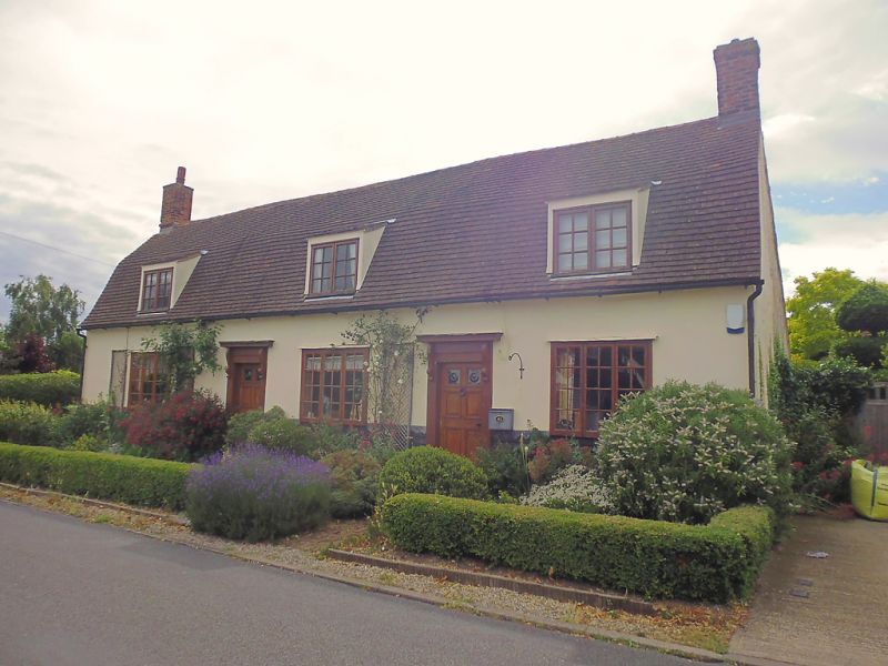
Pair of cottages. C17/C18. Timber framed, part weatherboarded, part plastered.
Red plain tiled gambrel roof. Left and right red brick chimney stacks. One
storey and attics. 3 catslide dormers. Three 3 light small paned casements.
Two 4 panelled 2 light doors, moulded canopies on brackets.
Listing NGR: TQ9555199428
External links are from the relevant listing authority and, where applicable, Wikidata. Wikidata IDs may be related buildings as well as this specific building. If you want to add or update a link, you will need to do so by editing the Wikidata entry.


Other nearby listed buildings