Approximate Location Map
Large Map »
Latitude: 50.9115 / 50°54'41"N
Longitude: -0.561 / 0°33'39"W
OS Eastings: 501264
OS Northings: 113432
OS Grid: TQ012134
Mapcode National: GBR FHF.WHH
Mapcode Global: FRA 96QP.M95
Plus Code: 9C2XWC6Q+HJ
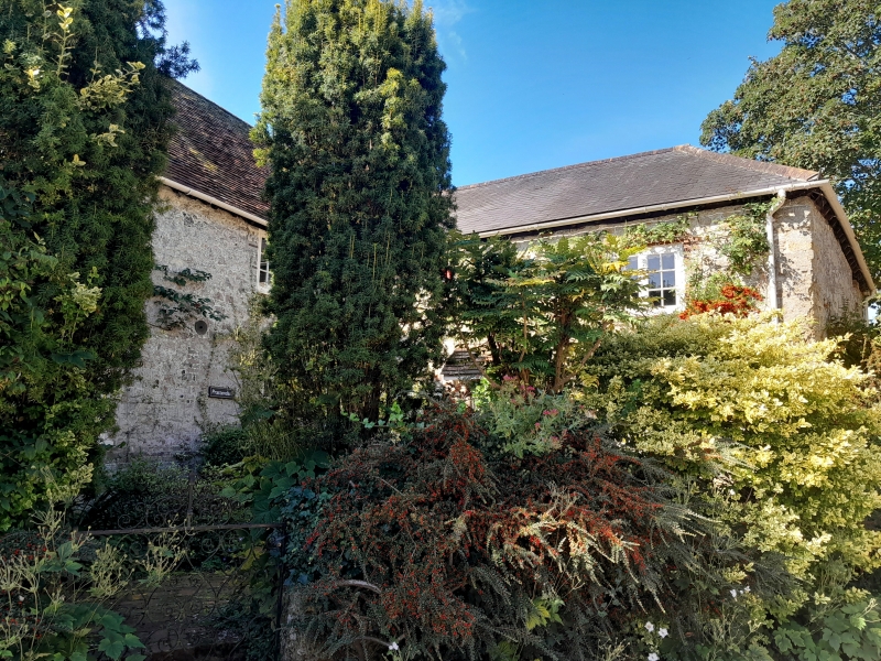
Entry Name: Prattendens
Listing Date: 22 May 1985
Grade: II
Source: Historic England
Source ID: 1237637
English Heritage Legacy ID: 300383
ID on this website: 101237637
Location: Bury, Chichester, West Sussex, RH20
County: West Sussex
District: Chichester
Civil Parish: Bury
Built-Up Area: Bury
Traditional County: Sussex
Lieutenancy Area (Ceremonial County): West Sussex
Church of England Parish: Bury St John the Evangelist with Houghton St Nicholas
Church of England Diocese: Chichester
Tagged with: Building
TQ 0113 BURY THE STREET
(east side)
26/20
Prattendens
II
House. L-shaped C18. Two storeys. Four windows. Stone rubble with ashlar quoins
Tiled roof. Casement windows.
Listing NGR: TQ0126413432
External links are from the relevant listing authority and, where applicable, Wikidata. Wikidata IDs may be related buildings as well as this specific building. If you want to add or update a link, you will need to do so by editing the Wikidata entry.


Other nearby listed buildings
