Approximate Location Map
Large Map »
Latitude: 51.0316 / 51°1'53"N
Longitude: 0.3757 / 0°22'32"E
OS Eastings: 566679
OS Northings: 128487
OS Grid: TQ666284
Mapcode National: GBR NSL.CSG
Mapcode Global: FRA C6PD.65P
Plus Code: 9F3229JG+J7
Entry Name: Barn at Stonegate Farm to the North West of the Farmhouse
Listing Date: 13 May 1987
Grade: II
Source: Historic England
Source ID: 1237649
English Heritage Legacy ID: 414870
ID on this website: 101237649
Location: Stonegate, Rother, East Sussex, TN5
County: East Sussex
District: Rother
Civil Parish: Ticehurst
Traditional County: Sussex
Lieutenancy Area (Ceremonial County): East Sussex
Church of England Parish: Stonegate St Peter
Church of England Diocese: Chichester
Tagged with: Barn
TQ 62 NE
4/13A
TICEHURST
STATION ROAD
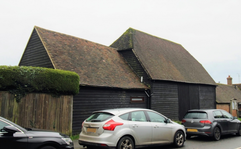
Barn at Stonegate Farm to the north west of the farmhouse
II
This building stands prominently near the cross-roads. C18. Faced with weather-
boarding. Half-hipped tiled roof. Continuations of lower elevation to the
north in weather-boarding and to the south in red brick.
Listing NGR: TQ6667928487
External links are from the relevant listing authority and, where applicable, Wikidata. Wikidata IDs may be related buildings as well as this specific building. If you want to add or update a link, you will need to do so by editing the Wikidata entry.


Other nearby listed buildings
