Approximate Location Map
Large Map »
Latitude: 51.0624 / 51°3'44"N
Longitude: 0.3772 / 0°22'38"E
OS Eastings: 566676
OS Northings: 131915
OS Grid: TQ666319
Mapcode National: GBR NS7.679
Mapcode Global: FRA C6P9.SXL
Plus Code: 9F32396G+XV
Entry Name: Barn at Chessons Farm to the South West of the Farmhouse
Listing Date: 13 May 1987
Grade: II
Source: Historic England
Source ID: 1237754
English Heritage Legacy ID: 415031
ID on this website: 101237754
Location: Birchett's Green, Rother, East Sussex, TN5
County: East Sussex
District: Rother
Civil Parish: Ticehurst
Traditional County: Sussex
Lieutenancy Area (Ceremonial County): East Sussex
Church of England Parish: Ticehurst St Mary
Church of England Diocese: Chichester
Tagged with: Barn
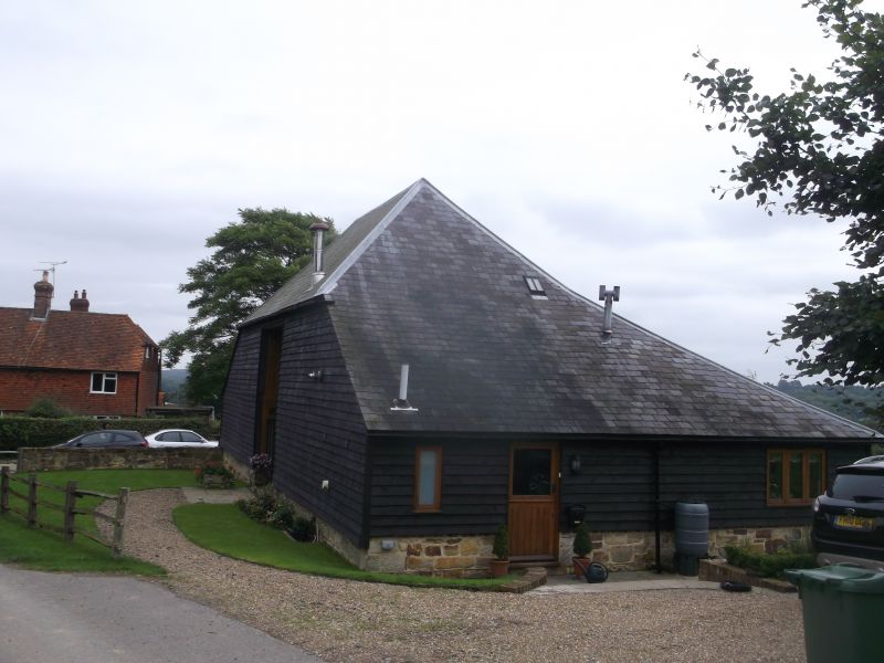
TQ 63 SE TICEHURST WARD'S LANE
1/6A Barn at Chessons Farm
to the south west of the
farmhouse
II
Timber-framed building of about 1700. Faced with weather-boarding on a red brick
base. Hipped slate roof.
Listing NGR: TQ6667631915
External links are from the relevant listing authority and, where applicable, Wikidata. Wikidata IDs may be related buildings as well as this specific building. If you want to add or update a link, you will need to do so by editing the Wikidata entry.


Other nearby listed buildings
