Approximate Location Map
Large Map »
Latitude: 50.974 / 50°58'26"N
Longitude: 0.0191 / 0°1'8"E
OS Eastings: 541853
OS Northings: 121343
OS Grid: TQ418213
Mapcode National: GBR KNQ.ZLJ
Mapcode Global: FRA B6XJ.R8L
Plus Code: 9F22X2F9+JJ
Entry Name: The Village Pump
Listing Date: 17 March 1952
Grade: II
Source: Historic England
Source ID: 1237886
English Heritage Legacy ID: 415232
ID on this website: 101237886
Location: Newick, Lewes, East Sussex, BN8
County: East Sussex
District: Lewes
Civil Parish: Newick
Built-Up Area: Newick
Traditional County: Sussex
Lieutenancy Area (Ceremonial County): East Sussex
Church of England Parish: Newick St Mary
Church of England Diocese: Chichester
Tagged with: Architectural structure
NEWICK THE GREEN
1.
5206
(centre)
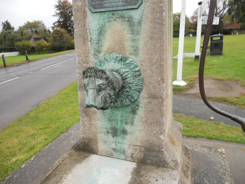
The Village Pump
TQ 4121 19/88
II
2.
Erected in 1897 to commemorate Queen Victoria's Diamond Jubilee. Stone obelisk
with acroteria-like top and trough. The spout is of iron and has the form
of a lion's head. The handle has the form of its tail.
Listing NGR: TQ4185321343
External links are from the relevant listing authority and, where applicable, Wikidata. Wikidata IDs may be related buildings as well as this specific building. If you want to add or update a link, you will need to do so by editing the Wikidata entry.


Other nearby listed buildings
