Approximate Location Map
Large Map »
Latitude: 51.3741 / 51°22'26"N
Longitude: 0.3236 / 0°19'25"E
OS Eastings: 561825
OS Northings: 166458
OS Grid: TQ618664
Mapcode National: GBR Z0.87R
Mapcode Global: VHHP8.KQGG
Plus Code: 9F3298FF+JF
Entry Name: Goldsmith Cottage
Listing Date: 22 October 1982
Grade: II
Source: Historic England
Source ID: 1238780
English Heritage Legacy ID: 416402
ID on this website: 101238780
Location: Hartley Hill, Sevenoaks, Kent, DA3
County: Kent
District: Sevenoaks
Civil Parish: Hartley
Traditional County: Kent
Lieutenancy Area (Ceremonial County): Kent
Church of England Parish: Hartley All Saints
Church of England Diocese: Rochester
Tagged with: Cottage Thatched cottage
HARTLEY HARTLEY BOTTOM ROAD
1.
5280
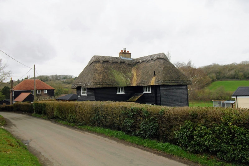
Goldsmith Cottage
TQ 66 NW 4/165
II
2.
C17 timber-framed building refaced in weatherboarding in the C18. L-shaped.
Two storeys tarred weatherboarding. Ripped thatched roof. Casement windows.
Listing NGR: TQ6182566458
External links are from the relevant listing authority and, where applicable, Wikidata. Wikidata IDs may be related buildings as well as this specific building. If you want to add or update a link, you will need to do so by editing the Wikidata entry.


Other nearby listed buildings
